Hlupín
Hlupín | |
|---|---|
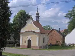 Chapel of Saint John of Nepomuk | |
 Hlupín Location in the Czech Republic | |
| Coordinates: 49°20′5″N 13°48′24″E / 49.33472°N 13.80667°E | |
| Country | |
| Region | South Bohemian |
| District | Strakonice |
| First mentioned | 1382 |
| Area | |
• Total | 4.74 km2 (1.83 sq mi) |
| Elevation | 458 m (1,503 ft) |
| Population (2025-01-01)[1] | |
• Total | 95 |
| • Density | 20/km2 (52/sq mi) |
| Time zone | UTC+1 (CET) |
| • Summer (DST) | UTC+2 (CEST) |
| Postal code | 386 01 |
| Website | www |
Hlupín is a municipality and village in Strakonice District in the South Bohemian Region of the Czech Republic. It has about 100 inhabitants.
Hlupín lies approximately 11 kilometres (7 mi) north-west of Strakonice, 63 km (39 mi) north-west of České Budějovice, and 95 km (59 mi) south-west of Prague.
Demographics
| Year | Pop. | ±% |
|---|---|---|
| 1869 | 274 | — |
| 1880 | 313 | +14.2% |
| 1890 | 303 | −3.2% |
| 1900 | 266 | −12.2% |
| 1910 | 284 | +6.8% |
| 1921 | 281 | −1.1% |
| 1930 | 266 | −5.3% |
| 1950 | 184 | −30.8% |
| 1961 | 176 | −4.3% |
| 1970 | 149 | −15.3% |
| 1980 | 115 | −22.8% |
| 1991 | 87 | −24.3% |
| 2001 | 97 | +11.5% |
| 2011 | 92 | −5.2% |
| 2021 | 84 | −8.7% |
| Source: Censuses[2][3] | ||
References
- ^ "Population of Municipalities – 1 January 2025". Czech Statistical Office. 2025-05-16.
- ^ "Historický lexikon obcí České republiky 1869–2011" (in Czech). Czech Statistical Office. 2015-12-21.
- ^ "Population Census 2021: Population by sex". Public Database. Czech Statistical Office. 2021-03-27.
External links
Wikimedia Commons has media related to Hlupín.