Přední Zborovice
Přední Zborovice | |
|---|---|
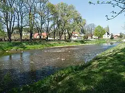 The Volyňka River in Přední Zborovice | |
 Flag  Coat of arms | |
 Přední Zborovice Location in the Czech Republic | |
| Coordinates: 49°13′7″N 13°53′32″E / 49.21861°N 13.89222°E | |
| Country | |
| Region | South Bohemian |
| District | Strakonice |
| First mentioned | 1318 |
| Area | |
• Total | 2.93 km2 (1.13 sq mi) |
| Elevation | 413 m (1,355 ft) |
| Population (2025-01-01)[1] | |
• Total | 94 |
| • Density | 32/km2 (83/sq mi) |
| Time zone | UTC+1 (CET) |
| • Summer (DST) | UTC+2 (CEST) |
| Postal code | 387 01 |
| Website | www |
Přední Zborovice is a municipality and village in Strakonice District in the South Bohemian Region of the Czech Republic. It has about 90 inhabitants.
Přední Zborovice lies approximately 5 kilometres (3 mi) south of Strakonice, 51 km (32 mi) north-west of České Budějovice, and 104 km (65 mi) south of Prague.
Demographics
| Year | Pop. | ±% |
|---|---|---|
| 1869 | 161 | — |
| 1880 | 165 | +2.5% |
| 1890 | 152 | −7.9% |
| 1900 | 161 | +5.9% |
| 1910 | 155 | −3.7% |
| 1921 | 162 | +4.5% |
| 1930 | 169 | +4.3% |
| 1950 | 156 | −7.7% |
| 1961 | 168 | +7.7% |
| 1970 | 133 | −20.8% |
| 1980 | 115 | −13.5% |
| 1991 | 88 | −23.5% |
| 2001 | 65 | −26.1% |
| 2011 | 92 | +41.5% |
| 2021 | 94 | +2.2% |
| Source: Censuses[2][3] | ||
References
- ^ "Population of Municipalities – 1 January 2025". Czech Statistical Office. 2025-05-16.
- ^ "Historický lexikon obcí České republiky 1869–2011" (in Czech). Czech Statistical Office. 2015-12-21.
- ^ "Population Census 2021: Population by sex". Public Database. Czech Statistical Office. 2021-03-27.
External links
Wikimedia Commons has media related to Přední Zborovice.