Miloňovice
Miloňovice | |
|---|---|
 Chapel of the Assumption of the Virgin Mary | |
 Flag  Coat of arms | |
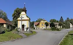
 Miloňovice Location in the Czech Republic | |
| Coordinates: 49°13′14″N 13°57′30″E / 49.22056°N 13.95833°E | |
| Country | |
| Region | South Bohemian |
| District | Strakonice |
| First mentioned | 1243 |
| Area | |
• Total | 6.28 km2 (2.42 sq mi) |
| Elevation | 480 m (1,570 ft) |
| Population (2025-01-01)[1] | |
• Total | 255 |
| • Density | 41/km2 (110/sq mi) |
| Time zone | UTC+1 (CET) |
| • Summer (DST) | UTC+2 (CEST) |
| Postal code | 386 01 |
| Website | www |
Miloňovice is a municipality and village in Strakonice District in the South Bohemian Region of the Czech Republic. It has about 300 inhabitants.
Miloňovice lies approximately 7 kilometres (4 mi) south-east of Strakonice, 47 km (29 mi) north-west of České Budějovice, and 103 km (64 mi) south of Prague.
Administrative division
Miloňovice consists of three municipal parts (in brackets population according to the 2021 census):[2]
- Miloňovice (222)
- Sudkovice (28)
- Nová Ves (3)
Demographics
| Year | Pop. | ±% |
|---|---|---|
| 1869 | 351 | — |
| 1880 | 364 | +3.7% |
| 1890 | 370 | +1.6% |
| 1900 | 349 | −5.7% |
| 1910 | 353 | +1.1% |
| 1921 | 354 | +0.3% |
| 1930 | 309 | −12.7% |
| 1950 | 273 | −11.7% |
| 1961 | 299 | +9.5% |
| 1970 | 263 | −12.0% |
| 1980 | 194 | −26.2% |
| 1991 | 217 | +11.9% |
| 2001 | 278 | +28.1% |
| 2011 | 267 | −4.0% |
| 2021 | 253 | −5.2% |
| Source: Censuses[3][4] | ||
References
- ^ "Population of Municipalities – 1 January 2025". Czech Statistical Office. 2025-05-16.
- ^ "Public Census 2021 – basic data". Public Database (in Czech). Czech Statistical Office. 2022.
- ^ "Historický lexikon obcí České republiky 1869–2011" (in Czech). Czech Statistical Office. 2015-12-21.
- ^ "Population Census 2021: Population by sex". Public Database. Czech Statistical Office. 2021-03-27.
External links
Wikimedia Commons has media related to Miloňovice.