Číhalín
Číhalín | |
|---|---|
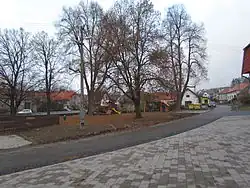 Centre of Číhalín | |
 Flag  Coat of arms | |
 Číhalín Location in the Czech Republic | |
| Coordinates: 49°16′7″N 15°48′43″E / 49.26861°N 15.81194°E | |
| Country | |
| Region | Vysočina |
| District | Třebíč |
| First mentioned | 1538 |
| Area | |
• Total | 6.34 km2 (2.45 sq mi) |
| Elevation | 489 m (1,604 ft) |
| Population (2025-01-01)[1] | |
• Total | 240 |
| • Density | 38/km2 (98/sq mi) |
| Time zone | UTC+1 (CET) |
| • Summer (DST) | UTC+2 (CEST) |
| Postal code | 675 07 |
| Website | www |
Číhalín is a municipality and village in Třebíč District in the Vysočina Region of the Czech Republic. It has about 200 inhabitants.
Číhalín lies approximately 8 kilometres (5 mi) north-west of Třebíč, 22 km (14 mi) south-east of Jihlava, and 136 km (85 mi) south-east of Prague.
History
The first written mention of Číhalín is from 1538.[2]
Demographics
| Year | Pop. | ±% |
|---|---|---|
| 1869 | 278 | — |
| 1880 | 272 | −2.2% |
| 1890 | 265 | −2.6% |
| 1900 | 283 | +6.8% |
| 1910 | 298 | +5.3% |
| 1921 | 318 | +6.7% |
| 1930 | 339 | +6.6% |
| 1950 | 317 | −6.5% |
| 1961 | 350 | +10.4% |
| 1970 | 234 | −33.1% |
| 1980 | 224 | −4.3% |
| 1991 | 179 | −20.1% |
| 2001 | 185 | +3.4% |
| 2011 | 192 | +3.8% |
| 2021 | 221 | +15.1% |
| Source: Censuses[3][4] | ||
References
- ^ "Population of Municipalities – 1 January 2025". Czech Statistical Office. 2025-05-16.
- ^ "O obci" (in Czech). Obec Číhalín. Retrieved 2022-10-21.
- ^ "Historický lexikon obcí České republiky 1869–2011" (in Czech). Czech Statistical Office. 2015-12-21.
- ^ "Population Census 2021: Population by sex". Public Database. Czech Statistical Office. 2021-03-27.
External links
Wikimedia Commons has media related to Číhalín.