Lesonice (Třebíč District)
Lesonice | |
|---|---|
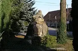 Centre of Lesonice | |
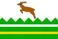 Flag  Coat of arms | |
 Lesonice Location in the Czech Republic | |
| Coordinates: 49°6′28″N 15°45′21″E / 49.10778°N 15.75583°E | |
| Country | |
| Region | Vysočina |
| District | Třebíč |
| First mentioned | 1190 |
| Area | |
• Total | 8.94 km2 (3.45 sq mi) |
| Elevation | 520 m (1,710 ft) |
| Population (2025-01-01)[1] | |
• Total | 490 |
| • Density | 55/km2 (140/sq mi) |
| Time zone | UTC+1 (CET) |
| • Summer (DST) | UTC+2 (CEST) |
| Postal code | 675 44 |
| Website | www |
Lesonice (German: Lessonitz) is a municipality and village in Třebíč District in the Vysočina Region of the Czech Republic. It has about 500 inhabitants.
Lesonice lies approximately 16 kilometres (10 mi) south-west of Třebíč, 34 km (21 mi) south of Jihlava, and 145 km (90 mi) south-east of Prague.
Administrative division
Lesonice consists of two municipal parts (in brackets population according to the 2021 census):[2]
- Lesonice (452)
- Horní Lažany (25)
Demographics
| Year | Pop. | ±% |
|---|---|---|
| 1869 | 562 | — |
| 1880 | 600 | +6.8% |
| 1890 | 578 | −3.7% |
| 1900 | 661 | +14.4% |
| 1910 | 629 | −4.8% |
| 1921 | 648 | +3.0% |
| 1930 | 656 | +1.2% |
| 1950 | 525 | −20.0% |
| 1961 | 581 | +10.7% |
| 1970 | 554 | −4.6% |
| 1980 | 516 | −6.9% |
| 1991 | 526 | +1.9% |
| 2001 | 484 | −8.0% |
| 2011 | 451 | −6.8% |
| 2021 | 477 | +5.8% |
| Source: Censuses[3][4] | ||
References
- ^ "Population of Municipalities – 1 January 2025". Czech Statistical Office. 2025-05-16.
- ^ "Public Census 2021 – basic data". Public Database (in Czech). Czech Statistical Office. 2022.
- ^ "Historický lexikon obcí České republiky 1869–2011" (in Czech). Czech Statistical Office. 2015-12-21.
- ^ "Population Census 2021: Population by sex". Public Database. Czech Statistical Office. 2021-03-27.
External links
Wikimedia Commons has media related to Lesonice (Třebíč District).