Bačice
Bačice | |
|---|---|
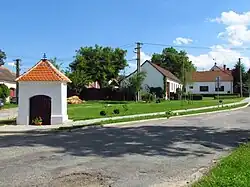 Centre of Bačice | |
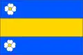 Flag 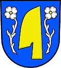 Coat of arms | |
 Bačice Location in the Czech Republic | |
| Coordinates: 49°5′2″N 16°1′39″E / 49.08389°N 16.02750°E | |
| Country | |
| Region | Vysočina |
| District | Třebíč |
| First mentioned | 1307 |
| Area | |
• Total | 5.33 km2 (2.06 sq mi) |
| Elevation | 425 m (1,394 ft) |
| Population (2025-01-01)[1] | |
• Total | 200 |
| • Density | 38/km2 (97/sq mi) |
| Time zone | UTC+1 (CET) |
| • Summer (DST) | UTC+2 (CEST) |
| Postal code | 675 55 |
| Website | www |
Bačice is a municipality and village in Třebíč District in the Vysočina Region of the Czech Republic. It has about 200 inhabitants.
Bačice lies approximately 18 kilometres (11 mi) south-east of Třebíč, 47 km (29 mi) south-east of Jihlava, and 161 km (100 mi) south-east of Prague.
Administrative division
Bačice consists of two municipal parts (in brackets population according to the 2021 census):[2]
- Bačice (124)
- Udeřice (73)
Demographics
| Year | Pop. | ±% |
|---|---|---|
| 1869 | 370 | — |
| 1880 | 364 | −1.6% |
| 1890 | 353 | −3.0% |
| 1900 | 350 | −0.8% |
| 1910 | 353 | +0.9% |
| 1921 | 366 | +3.7% |
| 1930 | 384 | +4.9% |
| 1950 | 343 | −10.7% |
| 1961 | 346 | +0.9% |
| 1970 | 301 | −13.0% |
| 1980 | 276 | −8.3% |
| 1991 | 231 | −16.3% |
| 2001 | 202 | −12.6% |
| 2011 | 194 | −4.0% |
| 2021 | 197 | +1.5% |
| Source: Censuses[3][4] | ||
References
- ^ "Population of Municipalities – 1 January 2025". Czech Statistical Office. 2025-05-16.
- ^ "Public Census 2021 – basic data". Public Database (in Czech). Czech Statistical Office. 2022.
- ^ "Historický lexikon obcí České republiky 1869–2011" (in Czech). Czech Statistical Office. 2015-12-21.
- ^ "Population Census 2021: Population by sex". Public Database. Czech Statistical Office. 2021-03-27.
External links
Wikimedia Commons has media related to Bačice.