Archignac
Archignac | |
|---|---|
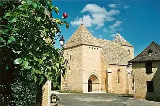 The church in Archignac | |
Location of Archignac | |
 Archignac  Archignac | |
| Coordinates: 45°00′43″N 1°18′46″E / 45.0119°N 1.3128°E | |
| Country | France |
| Region | Nouvelle-Aquitaine |
| Department | Dordogne |
| Arrondissement | Sarlat-la-Canéda |
| Canton | Terrasson-Lavilledieu |
| Government | |
| • Mayor (2020–2026) | Alain Laporte[1] |
Area 1 | 22.90 km2 (8.84 sq mi) |
| Population (2022)[2] | 403 |
| • Density | 18/km2 (46/sq mi) |
| Time zone | UTC+01:00 (CET) |
| • Summer (DST) | UTC+02:00 (CEST) |
| INSEE/Postal code | 24012 /24590 |
| Elevation | 157–323 m (515–1,060 ft) (avg. 300 m or 980 ft) |
| 1 French Land Register data, which excludes lakes, ponds, glaciers > 1 km2 (0.386 sq mi or 247 acres) and river estuaries. | |
Archignac (French pronunciation: [aʁʃiɲak]; Occitan: Archinhac) is a commune in the Dordogne department in Nouvelle-Aquitaine in southwestern France.
Population
| Year | Pop. | ±% |
|---|---|---|
| 1962 | 355 | — |
| 1968 | 352 | −0.8% |
| 1975 | 318 | −9.7% |
| 1982 | 309 | −2.8% |
| 1990 | 302 | −2.3% |
| 1999 | 297 | −1.7% |
| 2008 | 334 | +12.5% |
See also
References
- ^ "Répertoire national des élus: les maires". data.gouv.fr, Plateforme ouverte des données publiques françaises (in French). 2 December 2020.
- ^ "Populations de référence 2022" (in French). The National Institute of Statistics and Economic Studies. 19 December 2024.
Wikimedia Commons has media related to Archignac.