La Douze
La Douze | |
|---|---|
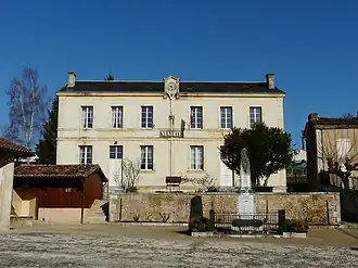 The town hall in La Douze | |
 Coat of arms | |
Location of La Douze | |
 La Douze  La Douze | |
| Coordinates: 45°03′45″N 0°51′52″E / 45.0625°N 0.8644°E | |
| Country | France |
| Region | Nouvelle-Aquitaine |
| Department | Dordogne |
| Arrondissement | Périgueux |
| Canton | Isle-Manoire |
| Intercommunality | Le Grand Périgueux |
| Government | |
| • Mayor (2020–2026) | Vincent Lacoste[1] |
Area 1 | 23.05 km2 (8.90 sq mi) |
| Population (2022)[2] | 1,147 |
| • Density | 50/km2 (130/sq mi) |
| Time zone | UTC+01:00 (CET) |
| • Summer (DST) | UTC+02:00 (CEST) |
| INSEE/Postal code | 24156 /24330 |
| Elevation | 132–267 m (433–876 ft) (avg. 200 m or 660 ft) |
| 1 French Land Register data, which excludes lakes, ponds, glaciers > 1 km2 (0.386 sq mi or 247 acres) and river estuaries. | |
La Douze (French pronunciation: [la duz]; Occitan: La Dosa) is a commune in the Dordogne department in Nouvelle-Aquitaine in southwestern France. Les Versannes station has rail connections to Périgueux and Agen.
Population
| Year | Pop. | ±% |
|---|---|---|
| 1962 | 701 | — |
| 1968 | 693 | −1.1% |
| 1975 | 700 | +1.0% |
| 1982 | 801 | +14.4% |
| 1990 | 866 | +8.1% |
| 1999 | 910 | +5.1% |
| 2008 | 1,018 | +11.9% |
History
The lordship of La Douze was acquired in 1372 by the Abzac family. It was converted to a marquisate in 1615, which lasted until 1943.
On Cassini's map of France between 1756 and 1789, the village is identified by the name Ladouze.
See also
References
- ^ "Répertoire national des élus: les maires". data.gouv.fr, Plateforme ouverte des données publiques françaises (in French). 9 August 2021.
- ^ "Populations de référence 2022" (in French). The National Institute of Statistics and Economic Studies. 19 December 2024.
Wikimedia Commons has media related to La Douze.