Bohas-Meyriat-Rignat
Bohas-Meyriat-Rignat | |
|---|---|
Commune | |
 | |
Location of Bohas-Meyriat-Rignat | |
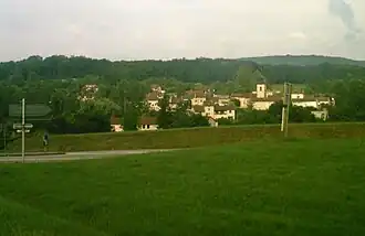
 Bohas-Meyriat-Rignat  Bohas-Meyriat-Rignat | |
| Coordinates: 46°08′14″N 5°23′28″E / 46.1372°N 5.3911°E | |
| Country | France |
| Region | Auvergne-Rhône-Alpes |
| Department | Ain |
| Arrondissement | Bourg-en-Bresse |
| Canton | Saint-Étienne-du-Bois |
| Intercommunality | CA Bassin de Bourg-en-Bresse |
| Government | |
| • Mayor (2020–2026) | Emmanuel Darmedru[1] |
Area 1 | 23.51 km2 (9.08 sq mi) |
| Population (2022)[2] | 951 |
| • Density | 40/km2 (100/sq mi) |
| Time zone | UTC+01:00 (CET) |
| • Summer (DST) | UTC+02:00 (CEST) |
| INSEE/Postal code | 01245 /01250 |
| Elevation | 264–555 m (866–1,821 ft) (avg. 420 m or 1,380 ft) |
| 1 French Land Register data, which excludes lakes, ponds, glaciers > 1 km2 (0.386 sq mi or 247 acres) and river estuaries. | |
Bohas-Meyriat-Rignat is a commune in the Ain department in eastern France.
History
The commune was created in January 1974 as a grouping of the three villages Bohas, Meyriat, and Rignat.
Population
| Year | Pop. | ±% p.a. |
|---|---|---|
| 1968 | 537 | — |
| 1975 | 506 | −0.85% |
| 1982 | 597 | +2.39% |
| 1990 | 657 | +1.20% |
| 1999 | 727 | +1.13% |
| 2009 | 804 | +1.01% |
| 2014 | 884 | +1.92% |
| 2020 | 950 | +1.21% |
| Source: INSEE[3] | ||
See also
References
- ^ "Répertoire national des élus: les maires". data.gouv.fr, Plateforme ouverte des données publiques françaises (in French). 2 December 2020. Archived from the original on 28 June 2020. Retrieved 3 May 2024.
- ^ "Populations de référence 2022" (in French). The National Institute of Statistics and Economic Studies. 19 December 2024.
- ^ Population en historique depuis 1968 Archived 10 December 2023 at the Wayback Machine, INSEE
Wikimedia Commons has media related to Bohas-Meyriat-Rignat.