Saint-Jean-de-Niost
Saint-Jean-de-Niost | |
|---|---|
Commune | |
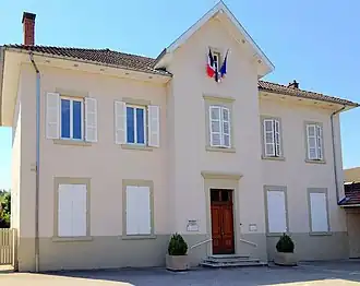 Town hall | |
.svg.png) Coat of arms | |
Location of Saint-Jean-de-Niost | |
 Saint-Jean-de-Niost  Saint-Jean-de-Niost | |
| Coordinates: 45°50′27″N 5°13′08″E / 45.8408°N 05.2189°E | |
| Country | France |
| Region | Auvergne-Rhône-Alpes |
| Department | Ain |
| Arrondissement | Belley |
| Canton | Lagnieu |
| Intercommunality | Plaine de l'Ain |
| Government | |
| • Mayor (2020–2026) | Béatrice Dalmaz[1] |
Area 1 | 14.19 km2 (5.48 sq mi) |
| Population (2022)[2] | 1,862 |
| • Density | 130/km2 (340/sq mi) |
| Time zone | UTC+01:00 (CET) |
| • Summer (DST) | UTC+02:00 (CEST) |
| INSEE/Postal code | 01361 /01800 |
| Elevation | 193–242 m (633–794 ft) (avg. 220 m or 720 ft) |
| 1 French Land Register data, which excludes lakes, ponds, glaciers > 1 km2 (0.386 sq mi or 247 acres) and river estuaries. | |
Saint-Jean-de-Niost (French pronunciation: [sɛ̃ ʒɑ̃ də njɔst]) is a commune in the Ain department in eastern France.
It lies on the edge of the Ain plain between Meximieux and Saint-Maurice-de-Gourdans.
Population
| Year | Pop. | ±% p.a. |
|---|---|---|
| 1968 | 248 | — |
| 1975 | 369 | +5.84% |
| 1982 | 490 | +4.13% |
| 1990 | 810 | +6.48% |
| 1999 | 1,082 | +3.27% |
| 2009 | 1,419 | +2.75% |
| 2014 | 1,426 | +0.10% |
| 2020 | 1,600 | +1.94% |
| Source: INSEE[3] | ||
See also
References
- ^ "Répertoire national des élus: les maires" (in French). data.gouv.fr, Plateforme ouverte des données publiques françaises. 13 September 2022. Archived from the original on 28 June 2020. Retrieved 7 May 2024.
- ^ "Populations de référence 2022" (in French). The National Institute of Statistics and Economic Studies. 19 December 2024.
- ^ Population en historique depuis 1968 Archived 12 December 2023 at the Wayback Machine, INSEE
External links
- Official site Archived 16 May 2006 at the Wayback Machine
Wikimedia Commons has media related to Saint-Jean-de-Niost.