Sandrans
Sandrans | |
|---|---|
Commune | |
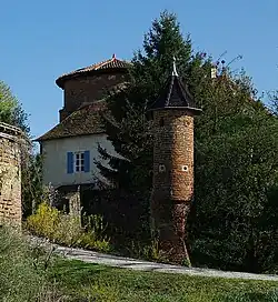 Chateau | |
.svg.png) Coat of arms | |
Location of Sandrans | |
 Sandrans  Sandrans | |
| Coordinates: 46°04′00″N 4°59′00″E / 46.0667°N 4.9833°E | |
| Country | France |
| Region | Auvergne-Rhône-Alpes |
| Department | Ain |
| Arrondissement | Bourg-en-Bresse |
| Canton | Châtillon-sur-Chalaronne |
| Intercommunality | Dombes |
| Government | |
| • Mayor (2020–2026) | Bernard Taponat[1] |
Area 1 | 29.03 km2 (11.21 sq mi) |
| Population (2022)[2] | 578 |
| • Density | 20/km2 (52/sq mi) |
| Time zone | UTC+01:00 (CET) |
| • Summer (DST) | UTC+02:00 (CEST) |
| INSEE/Postal code | 01393 /01100 |
| Elevation | 235–291 m (771–955 ft) (avg. 280 m or 920 ft) |
| 1 French Land Register data, which excludes lakes, ponds, glaciers > 1 km2 (0.386 sq mi or 247 acres) and river estuaries. | |
Sandrans (French pronunciation: [sɑ̃dʁɑ̃] ⓘ; Arpitan: Sandrens) is a commune in the Ain department in eastern France.
Geography
The Chalaronne forms parts of the commune's northeastern border.[3]
Population
| Year | Pop. | ±% p.a. |
|---|---|---|
| 1968 | 361 | — |
| 1975 | 366 | +0.20% |
| 1982 | 379 | +0.50% |
| 1990 | 346 | −1.13% |
| 1999 | 416 | +2.07% |
| 2009 | 527 | +2.39% |
| 2014 | 514 | −0.50% |
| 2020 | 555 | +1.29% |
| Source: INSEE[4] | ||
See also
References
- ^ "Répertoire national des élus: les maires" (in French). data.gouv.fr, Plateforme ouverte des données publiques françaises. 13 September 2022. Archived from the original on 28 June 2020. Retrieved 7 May 2024.
- ^ "Populations de référence 2022" (in French). The National Institute of Statistics and Economic Studies. 19 December 2024.
- ^ "Map of Sandrans - Michelin Sandrans map". ViaMichelin. Archived from the original on 17 January 2019. Retrieved 17 January 2019.
- ^ Population en historique depuis 1968 Archived 12 December 2023 at the Wayback Machine, INSEE
Wikimedia Commons has media related to Sandrans.