Condamine, Ain
Condamine | |
|---|---|
Commune | |
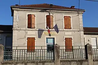 Town hall | |
Location of Condamine | |
 Condamine  Condamine | |
| Coordinates: 46°06′34″N 5°33′05″E / 46.1094°N 5.5514°E | |
| Country | France |
| Region | Auvergne-Rhône-Alpes |
| Department | Ain |
| Arrondissement | Nantua |
| Canton | Plateau d'Hauteville |
| Intercommunality | Haut-Bugey Agglomération |
| Government | |
| • Mayor (2020–2026) | Damien Vailloud[1] |
Area 1 | 4.64 km2 (1.79 sq mi) |
| Population (2022)[2] | 477 |
| • Density | 100/km2 (270/sq mi) |
| Time zone | UTC+01:00 (CET) |
| • Summer (DST) | UTC+02:00 (CEST) |
| INSEE/Postal code | 01112 /01430 |
| Elevation | 518–808 m (1,699–2,651 ft) (avg. 550 m or 1,800 ft) |
| 1 French Land Register data, which excludes lakes, ponds, glaciers > 1 km2 (0.386 sq mi or 247 acres) and river estuaries. | |
Condamine (French pronunciation: [kɔ̃damin] ⓘ) is a commune in the Ain department in eastern France.
Population
| Year | Pop. | ±% p.a. |
|---|---|---|
| 1968 | 182 | — |
| 1975 | 148 | −2.91% |
| 1982 | 194 | +3.94% |
| 1990 | 248 | +3.12% |
| 1999 | 285 | +1.56% |
| 2009 | 396 | +3.34% |
| 2014 | 416 | +0.99% |
| 2020 | 467 | +1.95% |
| Source: INSEE[3] | ||
See also
References
- ^ "Répertoire national des élus: les maires" (in French). data.gouv.fr, Plateforme ouverte des données publiques françaises. 13 September 2022. Archived from the original on 28 June 2020. Retrieved 3 May 2024.
- ^ "Populations de référence 2022" (in French). The National Institute of Statistics and Economic Studies. 19 December 2024.
- ^ Population en historique depuis 1968 Archived 10 December 2023 at the Wayback Machine, INSEE
Wikimedia Commons has media related to Condamine (Ain).