Villette-sur-Ain
Villette-sur-Ain | |
|---|---|
Commune | |
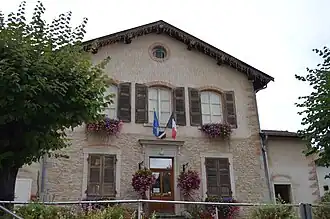 Town hall | |
.svg.png) Coat of arms | |
Location of Villette-sur-Ain | |
 Villette-sur-Ain  Villette-sur-Ain | |
| Coordinates: 45°59′14″N 5°16′06″E / 45.9872°N 5.2683°E | |
| Country | France |
| Region | Auvergne-Rhône-Alpes |
| Department | Ain |
| Arrondissement | Bourg-en-Bresse |
| Canton | Ceyzériat |
| Government | |
| • Mayor (2020–2026) | Jean-Pierre Humbert[1] |
Area 1 | 19.38 km2 (7.48 sq mi) |
| Population (2022)[2] | 763 |
| • Density | 39/km2 (100/sq mi) |
| Time zone | UTC+01:00 (CET) |
| • Summer (DST) | UTC+02:00 (CEST) |
| INSEE/Postal code | 01449 /01320 |
| Elevation | 222–331 m (728–1,086 ft) (avg. 235 m or 771 ft) |
| 1 French Land Register data, which excludes lakes, ponds, glaciers > 1 km2 (0.386 sq mi or 247 acres) and river estuaries. | |
Villette-sur-Ain (French pronunciation: [vilɛt syʁ ɛ̃], literally Villette on Ain, before 1991: Villette)[3] is a commune in the Ain department in eastern France. It is located on the banks of the Ain river in the Rhône-Alpes region. Villette-sur-Ain is part of the Dombes and is about 45 km from Lyon.
Population
| Year | Pop. | ±% p.a. |
|---|---|---|
| 1968 | 287 | — |
| 1975 | 341 | +2.49% |
| 1982 | 381 | +1.60% |
| 1990 | 412 | +0.98% |
| 1999 | 472 | +1.52% |
| 2009 | 669 | +3.55% |
| 2014 | 704 | +1.03% |
| 2020 | 760 | +1.28% |
| Source: INSEE[4] | ||
See also
References
- ^ "Répertoire national des élus: les maires". data.gouv.fr, Plateforme ouverte des données publiques françaises (in French). 2 December 2020. Archived from the original on 28 June 2020. Retrieved 7 May 2024.
- ^ "Populations de référence 2022" (in French). The National Institute of Statistics and Economic Studies. 19 December 2024.
- ^ Décret du 14 mars 1991 portant changement de nom de communes, Légifrance.
- ^ Population en historique depuis 1968 Archived 12 December 2023 at the Wayback Machine, INSEE
External links
Wikimedia Commons has media related to Villette-sur-Ain.