Francheleins
Francheleins | |
|---|---|
Commune | |
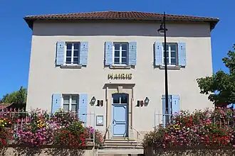 Town hall | |
Location of Francheleins | |
 Francheleins  Francheleins | |
| Coordinates: 46°04′28″N 4°48′33″E / 46.0744°N 4.8092°E | |
| Country | France |
| Region | Auvergne-Rhône-Alpes |
| Department | Ain |
| Arrondissement | Bourg-en-Bresse |
| Canton | Villars-les-Dombes |
| Intercommunality | Val de Saône Centre |
| Government | |
| • Mayor (2020–2026) | Jean-Michel Lux[1] |
Area 1 | 13.56 km2 (5.24 sq mi) |
| Population (2022)[2] | 1,593 |
| • Density | 120/km2 (300/sq mi) |
| Time zone | UTC+01:00 (CET) |
| • Summer (DST) | UTC+02:00 (CEST) |
| INSEE/Postal code | 01165 /01090 |
| Elevation | 209–269 m (686–883 ft) (avg. 213 m or 699 ft) |
| 1 French Land Register data, which excludes lakes, ponds, glaciers > 1 km2 (0.386 sq mi or 247 acres) and river estuaries. | |
Francheleins (French pronunciation: [fʁɑ̃ʃlɛ̃], before 1998: Amareins-Francheleins-Cesseins)[3] is a commune in the Ain department in eastern France.
Population
| Year | Pop. | ±% p.a. |
|---|---|---|
| 1968 | 355 | — |
| 1975 | 415 | +2.26% |
| 1982 | 572 | +4.69% |
| 1990 | 826 | +4.70% |
| 1999 | 994 | +2.08% |
| 2007 | 1,165 | +2.00% |
| 2012 | 1,450 | +4.47% |
| 2017 | 1,611 | +2.13% |
| Source: INSEE[4] | ||
See also
References
- ^ "Répertoire national des élus: les maires" (in French). data.gouv.fr, Plateforme ouverte des données publiques françaises. 13 September 2022. Archived from the original on 28 June 2020. Retrieved 6 May 2024.
- ^ "Populations de référence 2022" (in French). The National Institute of Statistics and Economic Studies. 19 December 2024.
- ^ Décret du 30 novembre 1998 portant changement de nom de communes, Légifrance.
- ^ Population en historique depuis 1968 Archived 26 July 2022 at the Wayback Machine, INSEE
Wikimedia Commons has media related to Francheleins.