Curciat-Dongalon
Curciat-Dongalon | |
|---|---|
Commune | |
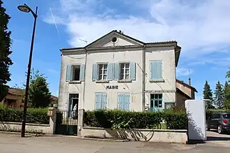 Town hall | |
Location of Curciat-Dongalon | |
 Curciat-Dongalon  Curciat-Dongalon | |
| Coordinates: 46°28′32″N 5°09′30″E / 46.4756°N 5.1583°E | |
| Country | France |
| Region | Auvergne-Rhône-Alpes |
| Department | Ain |
| Arrondissement | Bourg-en-Bresse |
| Canton | Replonges |
| Intercommunality | CA Bassin de Bourg-en-Bresse |
| Government | |
| • Mayor (2020–2026) | Didier Fleury[1] |
Area 1 | 23.94 km2 (9.24 sq mi) |
| Population (2022)[2] | 462 |
| • Density | 19/km2 (50/sq mi) |
| Time zone | UTC+01:00 (CET) |
| • Summer (DST) | UTC+02:00 (CEST) |
| INSEE/Postal code | 01139 /01560 |
| Elevation | 187–218 m (614–715 ft) (avg. 216 m or 709 ft) |
| 1 French Land Register data, which excludes lakes, ponds, glaciers > 1 km2 (0.386 sq mi or 247 acres) and river estuaries. | |
Curciat-Dongalon (French pronunciation: [kyʁsja dɔ̃ɡalɔ̃]) is a commune in the Ain department in eastern France.
Geography
The Sâne Morte forms part of the commune's north-eastern border. The Sâne Vive flows northward through the middle of the commune.
Population
| Year | Pop. | ±% p.a. |
|---|---|---|
| 1968 | 725 | — |
| 1975 | 575 | −3.26% |
| 1982 | 512 | −1.64% |
| 1990 | 449 | −1.63% |
| 1999 | 404 | −1.17% |
| 2009 | 454 | +1.17% |
| 2014 | 451 | −0.13% |
| 2020 | 444 | −0.26% |
| Source: INSEE[3] | ||
See also
References
- ^ "Répertoire national des élus: les maires". data.gouv.fr, Plateforme ouverte des données publiques françaises (in French). 2 December 2020. Archived from the original on 28 June 2020. Retrieved 3 May 2024.
- ^ "Populations de référence 2022" (in French). The National Institute of Statistics and Economic Studies. 19 December 2024.
- ^ Population en historique depuis 1968 Archived 10 December 2023 at the Wayback Machine, INSEE
Wikimedia Commons has media related to Curciat-Dongalon.