Bouillonville
Bouillonville | |
|---|---|
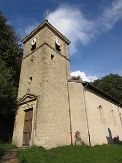 The church in Bouillonville | |
 Coat of arms | |
Location of Bouillonville | |
 Bouillonville  Bouillonville | |
| Coordinates: 48°56′43″N 5°50′35″E / 48.9453°N 5.8431°E | |
| Country | France |
| Region | Grand Est |
| Department | Meurthe-et-Moselle |
| Arrondissement | Toul |
| Canton | Le Nord-Toulois |
| Government | |
| • Mayor (2020–2026) | Gérard Renouard[1] |
Area 1 | 5.32 km2 (2.05 sq mi) |
| Population (2022)[2] | 146 |
| • Density | 27/km2 (71/sq mi) |
| Time zone | UTC+01:00 (CET) |
| • Summer (DST) | UTC+02:00 (CEST) |
| INSEE/Postal code | 54087 /54470 |
| Elevation | 205–264 m (673–866 ft) (avg. 209 m or 686 ft) |
| 1 French Land Register data, which excludes lakes, ponds, glaciers > 1 km2 (0.386 sq mi or 247 acres) and river estuaries. | |
Bouillonville (French pronunciation: [bujɔ̃vil]) is a commune in the Meurthe-et-Moselle department in northeastern France.
Geography
The village lies on the left bank of the Rupt de Mad, which flows north through the middle of the commune.
Population
| Year | Pop. | ±% p.a. |
|---|---|---|
| 1968 | 102 | — |
| 1975 | 85 | −2.57% |
| 1982 | 76 | −1.59% |
| 1990 | 80 | +0.64% |
| 1999 | 91 | +1.44% |
| 2009 | 121 | +2.89% |
| 2014 | 141 | +3.11% |
| 2020 | 149 | +0.92% |
| Source: INSEE[3] | ||
Sights
- The German war cemetery, where rest 1,368 German soldiers from World War I.[4]
See also
References
- ^ "Répertoire national des élus: les maires". data.gouv.fr, Plateforme ouverte des données publiques françaises (in French). 2 December 2020.
- ^ "Populations de référence 2022" (in French). The National Institute of Statistics and Economic Studies. 19 December 2024.
- ^ Population en historique depuis 1968, INSEE
- ^ "Seite nicht gefunden". www.ich-bin-gegen-gewalt.de. Retrieved 8 April 2018.
Wikimedia Commons has media related to Bouillonville.