Omelmont
Omelmont | |
|---|---|
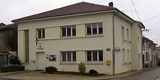 The town hall in Omelmont | |
 Coat of arms | |
Location of Omelmont | |
 Omelmont  Omelmont | |
| Coordinates: 48°30′05″N 6°06′45″E / 48.5014°N 6.1125°E | |
| Country | France |
| Region | Grand Est |
| Department | Meurthe-et-Moselle |
| Arrondissement | Nancy |
| Canton | Meine au Saintois |
| Intercommunality | CC Pays du Saintois |
| Government | |
| • Mayor (2020–2026) | Michel Henrion[1] |
Area 1 | 4.69 km2 (1.81 sq mi) |
| Population (2022)[2] | 193 |
| • Density | 41/km2 (110/sq mi) |
| Time zone | UTC+01:00 (CET) |
| • Summer (DST) | UTC+02:00 (CEST) |
| INSEE/Postal code | 54409 /54330 |
| Elevation | 265–307 m (869–1,007 ft) (avg. 294 m or 965 ft) |
| 1 French Land Register data, which excludes lakes, ponds, glaciers > 1 km2 (0.386 sq mi or 247 acres) and river estuaries. | |
Omelmont (French pronunciation: [ɔmɛlmɔ̃]) is a commune in the Meurthe-et-Moselle department in north-eastern France.
See also
References
- ^ "Répertoire national des élus: les maires". data.gouv.fr, Plateforme ouverte des données publiques françaises (in French). 9 August 2021.
- ^ "Populations de référence 2022" (in French). The National Institute of Statistics and Economic Studies. 19 December 2024.
Wikimedia Commons has media related to Omelmont.