Herserange
Herserange | |
|---|---|
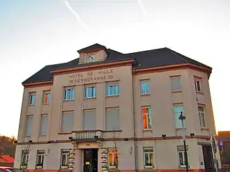 The town hall in Herserange | |
.svg.png) Coat of arms | |
Location of Herserange | |
 Herserange  Herserange | |
| Coordinates: 49°31′08″N 5°47′06″E / 49.5189°N 5.785°E | |
| Country | France |
| Region | Grand Est |
| Department | Meurthe-et-Moselle |
| Arrondissement | Val-de-Briey |
| Canton | Longwy |
| Intercommunality | Grand Longwy Agglomération |
| Government | |
| • Mayor (2020–2026) | Gérard Didelot[1] |
Area 1 | 3.54 km2 (1.37 sq mi) |
| Population (2022)[2] | 4,176 |
| • Density | 1,200/km2 (3,100/sq mi) |
| Time zone | UTC+01:00 (CET) |
| • Summer (DST) | UTC+02:00 (CEST) |
| INSEE/Postal code | 54261 /54440 |
| Elevation | 258–445 m (846–1,460 ft) (avg. 283 m or 928 ft) |
| 1 French Land Register data, which excludes lakes, ponds, glaciers > 1 km2 (0.386 sq mi or 247 acres) and river estuaries. | |
Herserange (French pronunciation: [ɛʁsəʁɑ̃ʒ]; German: Herseringen, Luxembourgish: Hiirkeréng/Hierkeréng) is a commune in the Meurthe-et-Moselle department in north-eastern France. It is part of the urban area of Longwy.[3]
Population
| Year | Pop. | ±% p.a. |
|---|---|---|
| 1968 | 7,044 | — |
| 1975 | 6,626 | −0.87% |
| 1982 | 4,918 | −4.17% |
| 1990 | 4,240 | −1.84% |
| 1999 | 4,327 | +0.23% |
| 2007 | 4,465 | +0.39% |
| 2012 | 4,391 | −0.33% |
| 2017 | 4,390 | −0.00% |
| Source: INSEE[4] | ||
See also
References
- ^ "Répertoire national des élus: les maires". data.gouv.fr, Plateforme ouverte des données publiques françaises (in French). 2 December 2020.
- ^ "Populations de référence 2022" (in French). The National Institute of Statistics and Economic Studies. 19 December 2024.
- ^ Unité urbaine 2020 de Longwy (partie française) (54405), INSEE
- ^ Population en historique depuis 1968, INSEE
Wikimedia Commons has media related to Herserange.