Gripport
Gripport | |
|---|---|
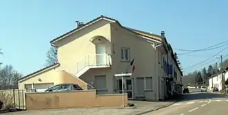 The town hall in Gripport | |
.svg.png) Coat of arms | |
Location of Gripport | |
 Gripport  Gripport | |
| Coordinates: 48°24′56″N 6°15′14″E / 48.4156°N 6.2539°E | |
| Country | France |
| Region | Grand Est |
| Department | Meurthe-et-Moselle |
| Arrondissement | Nancy |
| Canton | Meine au Saintois |
| Intercommunality | CC Pays du Saintois |
| Government | |
| • Mayor (2021–2026) | Marie-Madeleine Schlachter[1] |
Area 1 | 5.74 km2 (2.22 sq mi) |
| Population (2022)[2] | 271 |
| • Density | 47/km2 (120/sq mi) |
| Time zone | UTC+01:00 (CET) |
| • Summer (DST) | UTC+02:00 (CEST) |
| INSEE/Postal code | 54238 /54290 |
| Elevation | 255–389 m (837–1,276 ft) (avg. 280 m or 920 ft) |
| 1 French Land Register data, which excludes lakes, ponds, glaciers > 1 km2 (0.386 sq mi or 247 acres) and river estuaries. | |
Gripport (French pronunciation: [ɡʁipɔʁ]) is a commune in the Meurthe-et-Moselle department in northeastern France.
See also
References
- ^ "Répertoire national des élus: les maires" (in French). data.gouv.fr, Plateforme ouverte des données publiques françaises. 4 May 2022.
- ^ "Populations de référence 2022" (in French). The National Institute of Statistics and Economic Studies. 19 December 2024.
Wikimedia Commons has media related to Gripport.