Bransat
Bransat | |
|---|---|
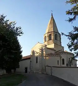 The church in Bransat | |
.svg.png) Coat of arms | |
Location of Bransat | |
 Bransat  Bransat | |
| Coordinates: 46°19′45″N 3°13′52″E / 46.3292°N 3.2311°E | |
| Country | France |
| Region | Auvergne-Rhône-Alpes |
| Department | Allier |
| Arrondissement | Vichy |
| Canton | Souvigny |
| Government | |
| • Mayor (2020–2026) | Sylvain Petit-Jean[1] |
Area 1 | 15.52 km2 (5.99 sq mi) |
| Population (2022)[2] | 529 |
| • Density | 34/km2 (88/sq mi) |
| Time zone | UTC+01:00 (CET) |
| • Summer (DST) | UTC+02:00 (CEST) |
| INSEE/Postal code | 03038 /03500 |
| Elevation | 254–401 m (833–1,316 ft) (avg. 340 m or 1,120 ft) |
| 1 French Land Register data, which excludes lakes, ponds, glaciers > 1 km2 (0.386 sq mi or 247 acres) and river estuaries. | |
Bransat (French pronunciation: [bʁɑ̃sa]) is a commune in the Allier department in central France.
Population
| Year | Pop. | ±% p.a. |
|---|---|---|
| 1968 | 571 | — |
| 1975 | 532 | −1.01% |
| 1982 | 536 | +0.11% |
| 1990 | 484 | −1.27% |
| 1999 | 508 | +0.54% |
| 2007 | 511 | +0.07% |
| 2012 | 488 | −0.92% |
| 2017 | 512 | +0.96% |
| Source: INSEE[3] | ||
See also
References
- ^ "Répertoire national des élus: les maires" (in French). data.gouv.fr, Plateforme ouverte des données publiques françaises. 13 September 2022.
- ^ "Populations de référence 2022" (in French). The National Institute of Statistics and Economic Studies. 19 December 2024.
- ^ Population en historique depuis 1968, INSEE
Wikimedia Commons has media related to Bransat.