Estivareilles, Allier
Estivareilles | |
|---|---|
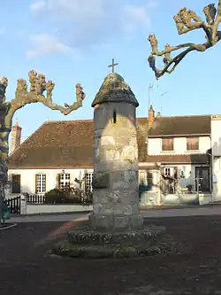 Lantern of the dead | |
Location of Estivareilles | |
 Estivareilles  Estivareilles | |
| Coordinates: 46°25′34″N 2°37′10″E / 46.4261°N 2.6194°E | |
| Country | France |
| Region | Auvergne-Rhône-Alpes |
| Department | Allier |
| Arrondissement | Montluçon |
| Canton | Huriel |
| Intercommunality | Val de Cher |
| Government | |
| • Mayor (2020–2026) | Georges Pailleret[1] |
Area 1 | 11.27 km2 (4.35 sq mi) |
| Population (2022)[2] | 1,114 |
| • Density | 99/km2 (260/sq mi) |
| Time zone | UTC+01:00 (CET) |
| • Summer (DST) | UTC+02:00 (CEST) |
| INSEE/Postal code | 03111 /03190 |
| Elevation | 179–348 m (587–1,142 ft) (avg. 230 m or 750 ft) |
| 1 French Land Register data, which excludes lakes, ponds, glaciers > 1 km2 (0.386 sq mi or 247 acres) and river estuaries. | |
Estivareilles (French pronunciation: [ɛstivaʁɛj]; Occitan: Estivarelhas) is a commune in the Allier department in central France. It lies about 10 km north of Montluçon on the right-hand side of the Cher river. There is a Lavoir (a public washing basin), a lantern of the dead and a church from the nineteenth century.
Population
| Year | Pop. | ±% p.a. |
|---|---|---|
| 1968 | 863 | — |
| 1975 | 939 | +1.21% |
| 1982 | 1,101 | +2.30% |
| 1990 | 1,104 | +0.03% |
| 1999 | 1,033 | −0.74% |
| 2009 | 1,085 | +0.49% |
| 2014 | 1,116 | +0.57% |
| 2020 | 1,117 | +0.01% |
| Source: INSEE[3] | ||
See also
References
- ^ "Répertoire national des élus: les maires". data.gouv.fr, Plateforme ouverte des données publiques françaises (in French). 2 December 2020.
- ^ "Populations de référence 2022" (in French). The National Institute of Statistics and Economic Studies. 19 December 2024.
- ^ Population en historique depuis 1968, INSEE
External links
- The official web site of the mayor of Estivareilles
- Estivareilles page at the National Geographical Institute (archived)
Wikimedia Commons has media related to Estivareilles, Allier.