La Ferté-Hauterive
La Ferté-Hauterive | |
|---|---|
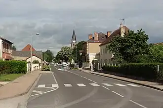 The main road in La Ferté-Hauterive | |
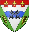 Coat of arms | |
Location of La Ferté-Hauterive | |
 La Ferté-Hauterive  La Ferté-Hauterive | |
| Coordinates: 46°23′51″N 3°20′28″E / 46.3975°N 3.3411°E | |
| Country | France |
| Region | Auvergne-Rhône-Alpes |
| Department | Allier |
| Arrondissement | Vichy |
| Canton | Moulins-2 |
| Intercommunality | Saint-Pourçain Sioule Limagne |
| Government | |
| • Mayor (2023–2026) | Patricia Dechet[1] |
Area 1 | 18.88 km2 (7.29 sq mi) |
| Population (2022)[2] | 260 |
| • Density | 14/km2 (36/sq mi) |
| Time zone | UTC+01:00 (CET) |
| • Summer (DST) | UTC+02:00 (CEST) |
| INSEE/Postal code | 03114 /03340 |
| Elevation | 214–239 m (702–784 ft) (avg. 234 m or 768 ft) |
| 1 French Land Register data, which excludes lakes, ponds, glaciers > 1 km2 (0.386 sq mi or 247 acres) and river estuaries. | |
La Ferté-Hauterive (French pronunciation: [la fɛʁte otʁiv]) is a commune in the Allier department in central France.
Population
| Year | Pop. | ±% p.a. |
|---|---|---|
| 1968 | 415 | — |
| 1975 | 338 | −2.89% |
| 1982 | 355 | +0.70% |
| 1990 | 273 | −3.23% |
| 1999 | 285 | +0.48% |
| 2009 | 288 | +0.10% |
| 2014 | 293 | +0.34% |
| 2020 | 271 | −1.29% |
| Source: INSEE[3] | ||
See also
References
- ^ "Répertoire national des élus: les maires" (in French). data.gouv.fr, Plateforme ouverte des données publiques françaises. 6 June 2023.
- ^ "Populations de référence 2022" (in French). The National Institute of Statistics and Economic Studies. 19 December 2024.
- ^ Population en historique depuis 1968, INSEE
Wikimedia Commons has media related to La Ferté-Hauterive.