Saint-Loup, Allier
Saint-Loup | |
|---|---|
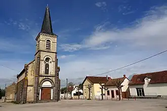 The church in Saint-Loup | |
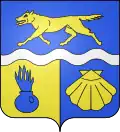 Coat of arms | |
Location of Saint-Loup | |
 Saint-Loup  Saint-Loup | |
| Coordinates: 46°21′07″N 3°22′43″E / 46.3519°N 3.3786°E | |
| Country | France |
| Region | Auvergne-Rhône-Alpes |
| Department | Allier |
| Arrondissement | Vichy |
| Canton | Saint-Pourçain-sur-Sioule |
| Intercommunality | Saint-Pourçain Sioule Limagne |
| Government | |
| • Mayor (2020–2026) | Gérard Longeot[1] |
Area 1 | 17.62 km2 (6.80 sq mi) |
| Population (2022)[2] | 572 |
| • Density | 32/km2 (84/sq mi) |
| Time zone | UTC+01:00 (CET) |
| • Summer (DST) | UTC+02:00 (CEST) |
| INSEE/Postal code | 03242 /03150 |
| Elevation | 225–292 m (738–958 ft) (avg. 244 m or 801 ft) |
| 1 French Land Register data, which excludes lakes, ponds, glaciers > 1 km2 (0.386 sq mi or 247 acres) and river estuaries. | |
Saint-Loup (French pronunciation: [sɛ̃ lu]) is a commune in the Allier department in Auvergne-Rhône-Alpes in central France.[3]
Population
| Year | Pop. | ±% p.a. |
|---|---|---|
| 1968 | 597 | — |
| 1975 | 578 | −0.46% |
| 1982 | 621 | +1.03% |
| 1990 | 619 | −0.04% |
| 1999 | 585 | −0.63% |
| 2009 | 594 | +0.15% |
| 2014 | 540 | −1.89% |
| 2020 | 565 | +0.76% |
| Source: INSEE[4] | ||
See also
References
- ^ "Répertoire national des élus: les maires". data.gouv.fr, Plateforme ouverte des données publiques françaises (in French). 2 December 2020.
- ^ "Populations de référence 2022" (in French). The National Institute of Statistics and Economic Studies. 19 December 2024.
- ^ INSEE commune file
- ^ Population en historique depuis 1968, INSEE
Wikimedia Commons has media related to Saint-Loup, Allier.