Chapeau, Allier
Chapeau | |
|---|---|
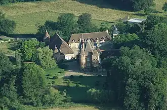 Castle | |
Location of Chapeau | |
 Chapeau  Chapeau | |
| Coordinates: 46°29′19″N 3°31′26″E / 46.4886°N 3.5239°E | |
| Country | France |
| Region | Auvergne-Rhône-Alpes |
| Department | Allier |
| Arrondissement | Moulins |
| Canton | Moulins-2 |
| Intercommunality | CA Moulins Communauté |
| Government | |
| • Mayor (2020–2026) | Pierre Brenon[1] |
Area 1 | 33.42 km2 (12.90 sq mi) |
| Population (2022)[2] | 236 |
| • Density | 7.1/km2 (18/sq mi) |
| Time zone | UTC+01:00 (CET) |
| • Summer (DST) | UTC+02:00 (CEST) |
| INSEE/Postal code | 03054 /03340 |
| Elevation | 239–285 m (784–935 ft) (avg. 256 m or 840 ft) |
| 1 French Land Register data, which excludes lakes, ponds, glaciers > 1 km2 (0.386 sq mi or 247 acres) and river estuaries. | |
Chapeau (French pronunciation: [ʃapo] ⓘ) is a commune in the Allier department in central France.
Population
| Year | Pop. | ±% p.a. |
|---|---|---|
| 1968 | 329 | — |
| 1975 | 295 | −1.55% |
| 1982 | 300 | +0.24% |
| 1990 | 264 | −1.59% |
| 1999 | 216 | −2.21% |
| 2009 | 225 | +0.41% |
| 2014 | 228 | +0.27% |
| 2020 | 237 | +0.65% |
| Source: INSEE[3] | ||
See also
References
- ^ "Répertoire national des élus: les maires" (in French). data.gouv.fr, Plateforme ouverte des données publiques françaises. 13 September 2022.
- ^ "Populations de référence 2022" (in French). The National Institute of Statistics and Economic Studies. 19 December 2024.
- ^ Population en historique depuis 1968, INSEE
Wikimedia Commons has media related to Chapeau.