Montmarault
Montmarault | |
|---|---|
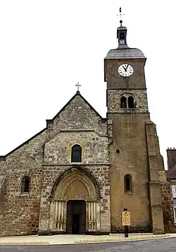 The church in Montmarault | |
 Coat of arms | |
Location of Montmarault | |
 Montmarault  Montmarault | |
| Coordinates: 46°19′06″N 2°57′20″E / 46.3183°N 2.9556°E | |
| Country | France |
| Region | Auvergne-Rhône-Alpes |
| Department | Allier |
| Arrondissement | Montluçon |
| Canton | Commentry |
| Intercommunality | Commentry Montmarault Néris Communauté |
| Government | |
| • Mayor (2020–2026) | Didier Lindron[1] |
Area 1 | 9 km2 (3 sq mi) |
| Population (2022)[2] | 1,522 |
| • Density | 170/km2 (440/sq mi) |
| Time zone | UTC+01:00 (CET) |
| • Summer (DST) | UTC+02:00 (CEST) |
| INSEE/Postal code | 03186 /03390 |
| Elevation | 394–498 m (1,293–1,634 ft) (avg. 487 m or 1,598 ft) |
| 1 French Land Register data, which excludes lakes, ponds, glaciers > 1 km2 (0.386 sq mi or 247 acres) and river estuaries. | |
Montmarault (French pronunciation: [mɔ̃maʁo]; Occitan: Montmaraut) is a commune in the Allier department in central France.
Population
| Year | Pop. | ±% p.a. |
|---|---|---|
| 1968 | 1,446 | — |
| 1975 | 1,366 | −0.81% |
| 1982 | 1,443 | +0.79% |
| 1990 | 1,597 | +1.28% |
| 1999 | 1,663 | +0.45% |
| 2009 | 1,550 | −0.70% |
| 2014 | 1,508 | −0.55% |
| 2020 | 1,523 | +0.17% |
| Source: INSEE[3] | ||
Tourism
The Petite Valette campground has been named the best camping of the Auvergne by the German ADAC.
See also
References
- ^ "Répertoire national des élus: les maires". data.gouv.fr, Plateforme ouverte des données publiques françaises (in French). 2 December 2020.
- ^ "Populations de référence 2022" (in French). The National Institute of Statistics and Economic Studies. 19 December 2024.
- ^ Population en historique depuis 1968, INSEE
Wikimedia Commons has media related to Montmarault.