Le Breuil, Allier
Le Breuil | |
|---|---|
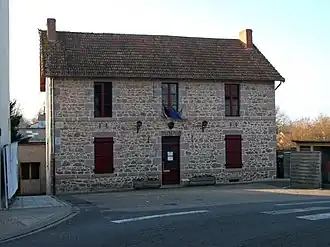 Town hall | |
 Coat of arms | |
Location of Le Breuil | |
 Le Breuil  Le Breuil | |
| Coordinates: 46°11′02″N 3°39′33″E / 46.1839°N 3.6592°E | |
| Country | France |
| Region | Auvergne-Rhône-Alpes |
| Department | Allier |
| Arrondissement | Vichy |
| Canton | Lapalisse |
| Intercommunality | Pays de Lapalisse |
| Government | |
| • Mayor (2020–2026) | Jacky Perrot[1] |
Area 1 | 34.55 km2 (13.34 sq mi) |
| Population (2022)[2] | 531 |
| • Density | 15/km2 (40/sq mi) |
| Demonym(s) | Breuillois (en/fr) Brogelians (en) Brogéliens (fr) |
| Time zone | UTC+01:00 (CET) |
| • Summer (DST) | UTC+02:00 (CEST) |
| INSEE/Postal code | 03042 /03120 |
| Elevation | 290–510 m (950–1,670 ft) (avg. 347 m or 1,138 ft) |
| Website | lebreuil03.fr (in French) |
| 1 French Land Register data, which excludes lakes, ponds, glaciers > 1 km2 (0.386 sq mi or 247 acres) and river estuaries. | |
Le Breuil (French pronunciation: [lə bʁœj]; Occitan: Lo Bruelh) is a commune in the Allier department in central France.
Population
Its inhabitants are called Breuillois[3] or Brogelians / Brogéliens.[4]
| Year | Pop. | ±% p.a. |
|---|---|---|
| 1968 | 805 | — |
| 1975 | 680 | −2.38% |
| 1982 | 613 | −1.47% |
| 1990 | 571 | −0.88% |
| 1999 | 553 | −0.36% |
| 2007 | 552 | −0.02% |
| 2012 | 550 | −0.07% |
| 2017 | 532 | −0.66% |
| Source: INSEE[5] | ||
See also
External links
- Commune website (in French)
References
- ^ "Répertoire national des élus: les maires" (in French). data.gouv.fr, Plateforme ouverte des données publiques françaises. 13 September 2022.
- ^ "Populations de référence 2022" (in French). The National Institute of Statistics and Economic Studies. 19 December 2024.
- ^ "Le Breuil (03120)". habitants.fr (in French). Retrieved 29 April 2024.
- ^ "Communauté de communes du Pays de Lapalisse". tresordesregions.mgm.fr (in French). Retrieved 29 April 2024.
- ^ Population en historique depuis 1968, INSEE
Wikimedia Commons has media related to Le Breuil, Allier.