Isserpent
Isserpent | |
|---|---|
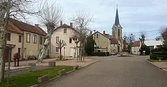 A view of Isserpent | |
 Coat of arms | |
Location of Isserpent | |
 Isserpent  Isserpent | |
| Coordinates: 46°09′49″N 3°36′35″E / 46.1636°N 3.6097°E | |
| Country | France |
| Region | Auvergne-Rhône-Alpes |
| Department | Allier |
| Arrondissement | Vichy |
| Canton | Lapalisse |
| Intercommunality | Pays de Lapalisse |
| Government | |
| • Mayor (2020–2026) | Louis Salles[1] |
Area 1 | 26.31 km2 (10.16 sq mi) |
| Population (2022)[2] | 560 |
| • Density | 21/km2 (55/sq mi) |
| Demonym | Isserpentois |
| Time zone | UTC+01:00 (CET) |
| • Summer (DST) | UTC+02:00 (CEST) |
| INSEE/Postal code | 03131 /03120 |
| Elevation | 316–543 m (1,037–1,781 ft) (avg. 350 m or 1,150 ft) |
| 1 French Land Register data, which excludes lakes, ponds, glaciers > 1 km2 (0.386 sq mi or 247 acres) and river estuaries. | |
Isserpent (French pronunciation: [isɛʁpɑ̃]) is a commune in the Allier department in central France.
Population
Its inhabitants are called Isserpentois.[3]
| Year | Pop. | ±% p.a. |
|---|---|---|
| 1968 | 677 | — |
| 1975 | 569 | −2.45% |
| 1982 | 536 | −0.85% |
| 1990 | 511 | −0.60% |
| 1999 | 485 | −0.58% |
| 2009 | 498 | +0.26% |
| 2014 | 518 | +0.79% |
| 2020 | 553 | +1.10% |
| Source: INSEE[4] | ||
See also
References
- ^ "Répertoire national des élus: les maires". data.gouv.fr, Plateforme ouverte des données publiques françaises (in French). 2 December 2020.
- ^ "Populations de référence 2022" (in French). The National Institute of Statistics and Economic Studies. 19 December 2024.
- ^ "Communauté de communes du Pays de Lapalisse". tresordesregions.mgm.fr (in French). Retrieved 29 May 2024.
- ^ Population en historique depuis 1968, INSEE
Wikimedia Commons has media related to Isserpent.