Collandres
Collandres | |
|---|---|
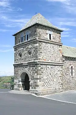 The church in Collandres | |
Location of Collandres | |
 Collandres  Collandres | |
| Coordinates: 45°14′14″N 2°39′29″E / 45.2372°N 2.6581°E | |
| Country | France |
| Region | Auvergne-Rhône-Alpes |
| Department | Cantal |
| Arrondissement | Mauriac |
| Canton | Riom-ès-Montagnes |
| Intercommunality | Pays Gentiane |
| Government | |
| • Mayor (2020–2026) | Charles Rodde[1] |
Area 1 | 43.32 km2 (16.73 sq mi) |
| Population (2022)[2] | 157 |
| • Density | 3.6/km2 (9.4/sq mi) |
| Time zone | UTC+01:00 (CET) |
| • Summer (DST) | UTC+02:00 (CEST) |
| INSEE/Postal code | 15052 /15400 |
| Elevation | 896–1,540 m (2,940–5,052 ft) (avg. 1,077 m or 3,533 ft) |
| 1 French Land Register data, which excludes lakes, ponds, glaciers > 1 km2 (0.386 sq mi or 247 acres) and river estuaries. | |
Collandres (French pronunciation: [kɔlɑ̃dʁ]; Occitan: Colandre) is a commune in the Cantal department in south-central France.
Population
| Year | Pop. | ±% |
|---|---|---|
| 1962 | 346 | — |
| 1968 | 414 | +19.7% |
| 1975 | 359 | −13.3% |
| 1982 | 322 | −10.3% |
| 1990 | 283 | −12.1% |
| 1999 | 223 | −21.2% |
| 2008 | 179 | −19.7% |
See also
References
- ^ "Répertoire national des élus: les maires". data.gouv.fr, Plateforme ouverte des données publiques françaises (in French). 2 December 2020.
- ^ "Populations de référence 2022" (in French). The National Institute of Statistics and Economic Studies. 19 December 2024.
Wikimedia Commons has media related to Collandres.