Thiézac
Thiézac | |
|---|---|
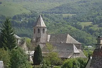 The church of Saint-Martin, in Thiézac | |
Location of Thiézac | |
 Thiézac  Thiézac | |
| Coordinates: 45°00′56″N 2°39′55″E / 45.0156°N 2.6653°E | |
| Country | France |
| Region | Auvergne-Rhône-Alpes |
| Department | Cantal |
| Arrondissement | Aurillac |
| Canton | Vic-sur-Cère |
| Intercommunality | Cère et Goul en Carladès |
| Government | |
| • Mayor (2020–2026) | Philippe Mourgues[1] |
Area 1 | 41.7 km2 (16.1 sq mi) |
| Population (2022)[2] | 596 |
| • Density | 14/km2 (37/sq mi) |
| Time zone | UTC+01:00 (CET) |
| • Summer (DST) | UTC+02:00 (CEST) |
| INSEE/Postal code | 15236 /15800 |
| Elevation | 673–1,565 m (2,208–5,135 ft) (avg. 805 m or 2,641 ft) |
| 1 French Land Register data, which excludes lakes, ponds, glaciers > 1 km2 (0.386 sq mi or 247 acres) and river estuaries. | |
Thiézac (French pronunciation: [tjezak]; Occitan: Tiesac) is a commune in the Cantal department in south-central France.
Population
| Year | Pop. | ±% |
|---|---|---|
| 1962 | 1,073 | — |
| 1968 | 1,010 | −5.9% |
| 1975 | 789 | −21.9% |
| 1982 | 742 | −6.0% |
| 1990 | 693 | −6.6% |
| 1999 | 614 | −11.4% |
| 2008 | 604 | −1.6% |
See also
References
- ^ "Répertoire national des élus: les maires". data.gouv.fr, Plateforme ouverte des données publiques françaises (in French). 9 August 2021.
- ^ "Populations de référence 2022" (in French). The National Institute of Statistics and Economic Studies. 19 December 2024.
Wikimedia Commons has media related to Thiézac.