Leynhac
Leynhac | |
|---|---|
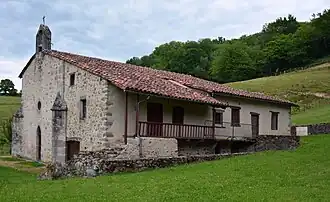 The priory of Our Lady of the Bridge | |
Location of Leynhac | |
 Leynhac  Leynhac | |
| Coordinates: 44°44′28″N 2°18′03″E / 44.7411°N 2.3008°E | |
| Country | France |
| Region | Auvergne-Rhône-Alpes |
| Department | Cantal |
| Arrondissement | Aurillac |
| Canton | Maurs |
| Intercommunality | Châtaigneraie Cantalienne |
| Government | |
| • Mayor (2020–2026) | Laurent Picarougne[1] |
Area 1 | 27.68 km2 (10.69 sq mi) |
| Population (2022)[2] | 315 |
| • Density | 11/km2 (29/sq mi) |
| Time zone | UTC+01:00 (CET) |
| • Summer (DST) | UTC+02:00 (CEST) |
| INSEE/Postal code | 15104 /15600 |
| Elevation | 275–652 m (902–2,139 ft) (avg. 480 m or 1,570 ft) |
| 1 French Land Register data, which excludes lakes, ponds, glaciers > 1 km2 (0.386 sq mi or 247 acres) and river estuaries. | |
Leynhac is a commune in the Cantal department in south-central France.
Population
| Year | Pop. | ±% |
|---|---|---|
| 1962 | 580 | — |
| 1968 | 656 | +13.1% |
| 1975 | 609 | −7.2% |
| 1982 | 518 | −14.9% |
| 1990 | 441 | −14.9% |
| 1999 | 386 | −12.5% |
| 2008 | 352 | −8.8% |
See also
References
- ^ "Répertoire national des élus: les maires". data.gouv.fr, Plateforme ouverte des données publiques françaises (in French). 9 August 2021.
- ^ "Populations de référence 2022" (in French). The National Institute of Statistics and Economic Studies. 19 December 2024.
Wikimedia Commons has media related to Leynhac.