Lascelle
Lascelle | |
|---|---|
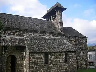 The church in Lascelle | |
Location of Lascelle | |
 Lascelle  Lascelle | |
| Coordinates: 45°01′25″N 2°34′34″E / 45.0236°N 2.5761°E | |
| Country | France |
| Region | Auvergne-Rhône-Alpes |
| Department | Cantal |
| Arrondissement | Aurillac |
| Canton | Vic-sur-Cère |
| Intercommunality | CA Aurillac Agglomération |
| Government | |
| • Mayor (2020–2026) | Jean-Michel Faubladier[1] |
Area 1 | 19.1 km2 (7.4 sq mi) |
| Population (2022)[2] | 266 |
| • Density | 14/km2 (36/sq mi) |
| Time zone | UTC+01:00 (CET) |
| • Summer (DST) | UTC+02:00 (CEST) |
| INSEE/Postal code | 15096 /15590 |
| Elevation | 708–1,337 m (2,323–4,386 ft) (avg. 760 m or 2,490 ft) |
| 1 French Land Register data, which excludes lakes, ponds, glaciers > 1 km2 (0.386 sq mi or 247 acres) and river estuaries. | |
Lascelle (French pronunciation: [lasɛl]; Occitan: Las Celas) is a commune in the Cantal department in south-central France.
Population
| Year | Pop. | ±% |
|---|---|---|
| 1962 | 380 | — |
| 1968 | 391 | +2.9% |
| 1975 | 335 | −14.3% |
| 1982 | 335 | +0.0% |
| 1990 | 325 | −3.0% |
| 1999 | 317 | −2.5% |
| 2008 | 312 | −1.6% |
See also
References
- ^ "Répertoire national des élus: les maires" (in French). data.gouv.fr, Plateforme ouverte des données publiques françaises. 13 September 2022.
- ^ "Populations de référence 2022" (in French). The National Institute of Statistics and Economic Studies. 19 December 2024.
Wikimedia Commons has media related to Lascelle.