Aure, Ardennes
Aure | |
|---|---|
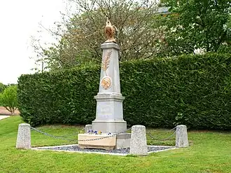 The Aure War memorial | |
Location of Aure | |
 Aure  Aure | |
| Coordinates: 49°16′29″N 4°38′11″E / 49.2747°N 4.6364°E | |
| Country | France |
| Region | Grand Est |
| Department | Ardennes |
| Arrondissement | Vouziers |
| Canton | Attigny |
| Intercommunality | CC Argonne Ardennaise |
| Government | |
| • Mayor (2020–2026) | Cédric Nicolitch[1] |
Area 1 | 12.72 km2 (4.91 sq mi) |
| Population (2022)[2] | 38 |
| • Density | 3.0/km2 (7.7/sq mi) |
| Time zone | UTC+01:00 (CET) |
| • Summer (DST) | UTC+02:00 (CEST) |
| INSEE/Postal code | 08031 /08400 |
| Elevation | 118–191 m (387–627 ft) (avg. 135 m or 443 ft) |
| 1 French Land Register data, which excludes lakes, ponds, glaciers > 1 km2 (0.386 sq mi or 247 acres) and river estuaries. | |
Aure (French pronunciation: [ɔʁ] ⓘ) is a commune in the Ardennes department in the Grand Est region of north-eastern France.
Geography
Aure is located some 55 km east of Reims and some 20 km south by south-west of Vouziers. The western border of the commune is the border between Ardennes and Marne departments. Access to the commune is by road D6 from Manre in the south-east which passes through the village and continues south-west, changing to the D20 in Marne, to Sommepy-Tahure. The D306 goes north-east from the village to Monthois. The commune is entirely farmland.[3]
The Allin river rises near the village and flows south-east to eventually join the Aisne at Brécy-Brières.[3]
History
Aure is cited in a poem by Louis Aragon Le conscrit des cent villages (The conscript of 100 villages) written as an act of intellectual resistance in a clandestine manner in 1943.[4]
French Decorations
![]()
Croix de guerre 1914-1918: awarded on 1 March 1921.
Neighbouring communes and villages
Places adjacent to Aure, Ardennes | |
|---|---|
Administration
List of Successive Mayors[5]
| From | To | Name |
|---|---|---|
| 1995 | 2020 | Michel Cartelet |
| 2020 | current | Cédric Nicolitch |
Demography
In 2017 the commune had 48 inhabitants.
|
| ||||||||||||||||||||||||||||||||||||||||||||||||||||||||||||||||||||||||||||||||||||||||||||||||||||||||||||
| Source: EHESS[6] and INSEE[7] | |||||||||||||||||||||||||||||||||||||||||||||||||||||||||||||||||||||||||||||||||||||||||||||||||||||||||||||
Notable people linked to the commune
- Auguste Achile Baudart, Colonel of the 122nd Infantry Regiment of the Line, born in Aure on 16 November 1844 from a farming family, died at Montpellier on 15 December 1898.[8]
Photo gallery
-
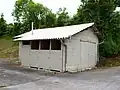 Public toilet
 -
 Grain Silo
 -
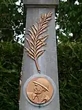 War memorial close-up
 -
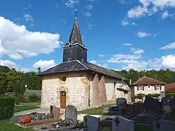
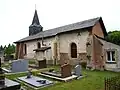 The church
 -
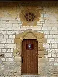 Entrance to the church
 -
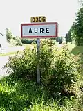 Entrance to the village
 -
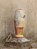 The Bomb
See also
References
- ^ "Répertoire national des élus: les maires". data.gouv.fr, Plateforme ouverte des données publiques françaises (in French). 2 December 2020.
- ^ "Populations de référence 2022" (in French). The National Institute of Statistics and Economic Studies. 19 December 2024.
- ^ a b c Google Maps
- ^ Louis Aragon, Le Conscrit des cent villages, initially published in La Diane française, consulted in Pierre Seghers, The Resistance and its poets: France, 1940-1945, Paris, Seghers, 2004 (2nd edition), ISBN 2-232-12242-5, p. 373-375 (in French)
- ^ List of Mayors of France (in French)
- ^ Des villages de Cassini aux communes d'aujourd'hui: Commune data sheet Aure, EHESS (in French).
- ^ Population en historique depuis 1968, INSEE
- ^ Almanach, Matot-Braine, 1900, Reims (in French)
External links
- Aure on Géoportail, National Geographic Institute (IGN) website (in French)
- Aure on the 1750 Cassini Map