Challerange
Challerange | |
|---|---|
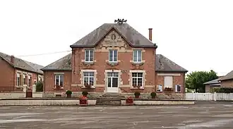 The town hall in Challerange | |
 Coat of arms | |
Location of Challerange | |
 Challerange  Challerange | |
| Coordinates: 49°18′41″N 4°44′46″E / 49.3114°N 4.7461°E | |
| Country | France |
| Region | Grand Est |
| Department | Ardennes |
| Arrondissement | Vouziers |
| Canton | Attigny |
| Intercommunality | Argonne Ardennaise |
| Government | |
| • Mayor (2020–2026) | Vincent Gavart[1] |
Area 1 | 11.13 km2 (4.30 sq mi) |
| Population (2022)[2] | 423 |
| • Density | 38/km2 (98/sq mi) |
| Time zone | UTC+01:00 (CET) |
| • Summer (DST) | UTC+02:00 (CEST) |
| INSEE/Postal code | 08097 /08400 |
| Elevation | 100–129 m (328–423 ft) (avg. 106 m or 348 ft) |
| 1 French Land Register data, which excludes lakes, ponds, glaciers > 1 km2 (0.386 sq mi or 247 acres) and river estuaries. | |
Challerange (French pronunciation: [ʃalʁɑ̃ʒ]) is a commune in the Ardennes department in northern France.
Population
| Year | Pop. | ±% |
|---|---|---|
| 1962 | 635 | — |
| 1968 | 643 | +1.3% |
| 1975 | 659 | +2.5% |
| 1982 | 594 | −9.9% |
| 1990 | 514 | −13.5% |
| 1999 | 461 | −10.3% |
| 2008 | 431 | −6.5% |
See also
References
- ^ "Répertoire national des élus: les maires". data.gouv.fr, Plateforme ouverte des données publiques françaises (in French). 9 August 2021.
- ^ "Populations de référence 2022" (in French). The National Institute of Statistics and Economic Studies. 19 December 2024.
Wikimedia Commons has media related to Challerange.