Tournes
Tournes | |
|---|---|
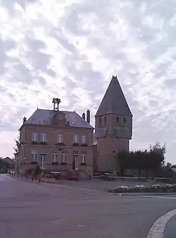 The church in Tournes | |
.svg.png) Coat of arms | |
Location of Tournes | |
 Tournes  Tournes | |
| Coordinates: 49°47′51″N 4°38′16″E / 49.7975°N 4.6378°E | |
| Country | France |
| Region | Grand Est |
| Department | Ardennes |
| Arrondissement | Charleville-Mézières |
| Canton | Charleville-Mézières-1 |
| Intercommunality | CA Ardenne Métropole |
| Government | |
| • Mayor (2024–2026) | Aline Haplik[1] |
Area 1 | 8.26 km2 (3.19 sq mi) |
| Population (2022)[2] | 1,058 |
| • Density | 130/km2 (330/sq mi) |
| Time zone | UTC+01:00 (CET) |
| • Summer (DST) | UTC+02:00 (CEST) |
| INSEE/Postal code | 08457 /08090 |
| Elevation | 140–180 m (460–590 ft) (avg. 152 m or 499 ft) |
| 1 French Land Register data, which excludes lakes, ponds, glaciers > 1 km2 (0.386 sq mi or 247 acres) and river estuaries. | |
Tournes (French pronunciation: [tuʁn] ⓘ) is a commune in the Ardennes department in northern France.
Population
| Year | Pop. | ±% |
|---|---|---|
| 1962 | 459 | — |
| 1968 | 509 | +10.9% |
| 1975 | 836 | +64.2% |
| 1982 | 904 | +8.1% |
| 1990 | 1,073 | +18.7% |
| 1999 | 1,075 | +0.2% |
| 2008 | 1,058 | −1.6% |
Geography
The river Sormonne forms most of the commune's southern border.
See also
References
- ^ "Répertoire national des élus: les maires" (in French). data.gouv.fr, Plateforme ouverte des données publiques françaises. 16 April 2024.
- ^ "Populations de référence 2022" (in French). The National Institute of Statistics and Economic Studies. 19 December 2024.
Wikimedia Commons has media related to Tournes.