Harricourt
Harricourt | |
|---|---|
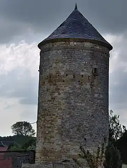 Dovecote | |
.svg.png) Coat of arms | |
Location of Harricourt | |
 Harricourt  Harricourt | |
| Coordinates: 49°26′05″N 4°55′48″E / 49.4347°N 4.93°E | |
| Country | France |
| Region | Grand Est |
| Department | Ardennes |
| Arrondissement | Vouziers |
| Canton | Vouziers |
| Intercommunality | Argonne Ardennaise |
| Government | |
| • Mayor (2020–2026) | Joël Carre[1] |
Area 1 | 7.87 km2 (3.04 sq mi) |
| Population (2022)[2] | 45 |
| • Density | 5.7/km2 (15/sq mi) |
| Time zone | UTC+01:00 (CET) |
| • Summer (DST) | UTC+02:00 (CEST) |
| INSEE/Postal code | 08215 /08240 |
| Elevation | 165–261 m (541–856 ft) (avg. 175 m or 574 ft) |
| 1 French Land Register data, which excludes lakes, ponds, glaciers > 1 km2 (0.386 sq mi or 247 acres) and river estuaries. | |
Harricourt (French pronunciation: [aʁikuʁ]) is a commune in the Ardennes department in northern France.
Population
| Year | Pop. | ±% |
|---|---|---|
| 1962 | 60 | — |
| 1968 | 80 | +33.3% |
| 1975 | 70 | −12.5% |
| 1982 | 74 | +5.7% |
| 1990 | 71 | −4.1% |
| 1999 | 60 | −15.5% |
| 2008 | 50 | −16.7% |
See also
References
- ^ "Répertoire national des élus: les maires". data.gouv.fr, Plateforme ouverte des données publiques françaises (in French). 2 December 2020.
- ^ "Populations de référence 2022" (in French). The National Institute of Statistics and Economic Studies. 19 December 2024.
Wikimedia Commons has media related to Harricourt (Ardennes).