Bizou
Bizou | |
|---|---|
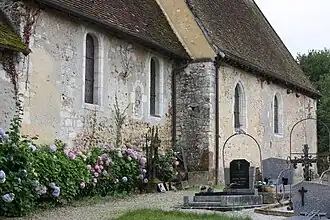 The church in Bizou | |
Location of Bizou | |
 Bizou  Bizou | |
| Coordinates: 48°29′48″N 0°45′04″E / 48.4967°N 0.7511°E | |
| Country | France |
| Region | Normandy |
| Department | Orne |
| Arrondissement | Mortagne-au-Perche |
| Canton | Tourouvre au Perche |
| Government | |
| • Mayor (2020–2026) | Philippe Blottière[1] |
Area 1 | 9.04 km2 (3.49 sq mi) |
| Population (2022)[2] | 141 |
| • Density | 16/km2 (40/sq mi) |
| Time zone | UTC+01:00 (CET) |
| • Summer (DST) | UTC+02:00 (CEST) |
| INSEE/Postal code | 61046 /61290 |
| Elevation | 145–251 m (476–823 ft) (avg. 154 m or 505 ft) |
| 1 French Land Register data, which excludes lakes, ponds, glaciers > 1 km2 (0.386 sq mi or 247 acres) and river estuaries. | |
Bizou (French pronunciation: [bizu] ⓘ) is a commune in the Orne department in northwestern France.
Geography
The Commune along with another 70 communes shares part of a 47,681 hectare, Natura 2000 conservation area, called the Forêts et étangs du Perche.[3]
Population
| Year | Pop. | ±% p.a. |
|---|---|---|
| 1968 | 128 | — |
| 1975 | 119 | −1.04% |
| 1982 | 108 | −1.38% |
| 1990 | 134 | +2.73% |
| 1999 | 116 | −1.59% |
| 2009 | 120 | +0.34% |
| 2014 | 122 | +0.33% |
| 2020 | 134 | +1.58% |
| Source: INSEE[4] | ||
See also
References
- ^ "Répertoire national des élus: les maires". data.gouv.fr, Plateforme ouverte des données publiques françaises (in French). 9 August 2021.
- ^ "Populations de référence 2022" (in French). The National Institute of Statistics and Economic Studies. 19 December 2024.
- ^ "INPN - FSD Natura 2000 - FR2512004 - Forêts et étangs du Perche - Description".
- ^ Population en historique depuis 1968, INSEE
Wikimedia Commons has media related to Bizou.