Ménil-Erreux
Ménil-Erreux | |
|---|---|
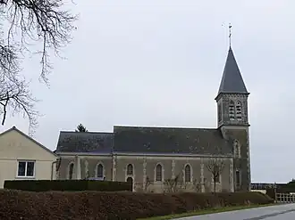 The church in Ménil-Erreux | |
Location of Ménil-Erreux | |
 Ménil-Erreux  Ménil-Erreux | |
| Coordinates: 48°30′28″N 0°11′21″E / 48.5078°N 0.1892°E | |
| Country | France |
| Region | Normandy |
| Department | Orne |
| Arrondissement | Alençon |
| Canton | Écouves |
| Intercommunality | CU Alençon |
| Government | |
| • Mayor (2020–2026) | Jérôme Larchevêque[1] |
Area 1 | 11.05 km2 (4.27 sq mi) |
| Population (2022)[2] | 195 |
| • Density | 18/km2 (46/sq mi) |
| Time zone | UTC+01:00 (CET) |
| • Summer (DST) | UTC+02:00 (CEST) |
| INSEE/Postal code | 61263 /61250 |
| Elevation | 140–181 m (459–594 ft) (avg. 160 m or 520 ft) |
| 1 French Land Register data, which excludes lakes, ponds, glaciers > 1 km2 (0.386 sq mi or 247 acres) and river estuaries. | |
Ménil-Erreux (French pronunciation: [menil ɛʁø] ⓘ) is a commune in the Orne department in north-western France.
Points of interest
National heritage sites
- Normanderie farm a nineteenth century farm, that was registered as a Monument historique in 2005.[3]
See also
References
- ^ "Répertoire national des élus: les maires". data.gouv.fr, Plateforme ouverte des données publiques françaises (in French). 2 December 2020.
- ^ "Populations de référence 2022" (in French). The National Institute of Statistics and Economic Studies. 19 December 2024.
- ^ "Ferme de la Normanderie à Ménil-Erreux - PA61000039". monumentum.fr.
Wikimedia Commons has media related to Ménil-Erreux.