Ménil-Hubert-sur-Orne
Ménil-Hubert-sur-Orne | |
|---|---|
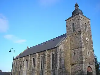 The church in Ménil-Hubert-sur-Orne | |
Location of Ménil-Hubert-sur-Orne | |
 Ménil-Hubert-sur-Orne  Ménil-Hubert-sur-Orne | |
| Coordinates: 48°51′11″N 0°24′43″W / 48.8531°N 0.4119°W | |
| Country | France |
| Region | Normandy |
| Department | Orne |
| Arrondissement | Argentan |
| Canton | Athis-Val de Rouvre |
| Intercommunality | CA Flers Agglo |
| Government | |
| • Mayor (2020–2026) | Jacky Alleau[1] |
Area 1 | 10.68 km2 (4.12 sq mi) |
| Population (2022)[2] | 487 |
| • Density | 46/km2 (120/sq mi) |
| Time zone | UTC+01:00 (CET) |
| • Summer (DST) | UTC+02:00 (CEST) |
| INSEE/Postal code | 61269 /61430 |
| Elevation | 46–236 m (151–774 ft) (avg. 110 m or 360 ft) |
| 1 French Land Register data, which excludes lakes, ponds, glaciers > 1 km2 (0.386 sq mi or 247 acres) and river estuaries. | |
Ménil-Hubert-sur-Orne (French pronunciation: [menil ybɛʁ syʁ ɔʁn] ⓘ, literally Ménil-Hubert on Orne) is a commune in the Orne department in north-western France.
Geography
The commune is part of the area known as Suisse Normande.[3]
The commune is made up of the following collection of villages and hamlets, Losier,Grignon, Le Hamel, La Branle, Rouvrou, La Batonnière, La Davillerie, Les Monts and Ménil-Hubert-sur-Orne.[4]
The Commune with another 20 communes shares part of a 2,115 hectare, Natura 2000 conservation area, called the Vallée de l'Orne et ses affluents.[5]
The commune has 4 watercourses running through it, with 3 rivers the Orne plus two of its tributaries the Noireau & the Rouvre.[6][7][8] The other watercourse is a stream called Ruisseau de la Mare des Bois.
Neighbouring communes[4] | ||||||||||||||||
|---|---|---|---|---|---|---|---|---|---|---|---|---|---|---|---|---|
| ||||||||||||||||
People linked with the commune
- Pierre Cally (1630-1709), a French Catholic Cartesian philosopher and theologian was born here.[9]
See also
References
- ^ "Répertoire national des élus: les maires". data.gouv.fr, Plateforme ouverte des données publiques françaises (in French). 2 December 2020.
- ^ "Populations de référence 2022" (in French). The National Institute of Statistics and Economic Studies. 19 December 2024.
- ^ "Map of Suisse Normande" (PDF).
- ^ a b "Google Maps". Google Maps.
- ^ "INPN - FSD Natura 2000 - FR2500091 - Vallée de l'Orne et ses affluents - Description".
- ^ Sandre. "Fiche cours d'eau - L'Orne (I2--0200)".
- ^ Sandre. "Fiche cours d'eau - The Rouvre (I23-0400)".
- ^ Sandre. "Fiche cours d'eau - The Noireau (I24-0400)".
- ^ "Pierre Cally (1630-1709)". data.bnf.fr.