Planches
Planches | |
|---|---|
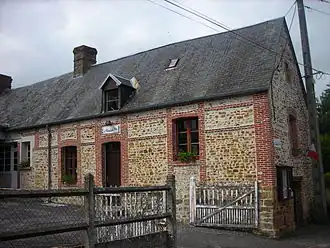 The town hall in Planches | |
Location of Planches | |
 Planches  Planches | |
| Coordinates: 48°42′09″N 0°22′17″E / 48.7025°N 0.3714°E | |
| Country | France |
| Region | Normandy |
| Department | Orne |
| Arrondissement | Mortagne-au-Perche |
| Canton | Rai |
| Intercommunality | Vallées d'Auge et du Merlerault |
| Government | |
| • Mayor (2020–2026) | Gérard Préel[1] |
Area 1 | 12.49 km2 (4.82 sq mi) |
| Population (2022)[2] | 181 |
| • Density | 14/km2 (38/sq mi) |
| Time zone | UTC+01:00 (CET) |
| • Summer (DST) | UTC+02:00 (CEST) |
| INSEE/Postal code | 61330 /61370 |
| Elevation | 239–308 m (784–1,010 ft) (avg. 257 m or 843 ft) |
| 1 French Land Register data, which excludes lakes, ponds, glaciers > 1 km2 (0.386 sq mi or 247 acres) and river estuaries. | |
Planches (French pronunciation: [plɑ̃ʃ] ⓘ) is a commune in the Orne department in north-western France.
Geography
The Commune is one of twenty-seven communes that make up the Natura 2000 protected area of Bocages et vergers du sud Pays d'Auge.[3]
The source of the river Risle is within this commune.[4]
See also
References
- ^ "Répertoire national des élus: les maires" (in French). data.gouv.fr, Plateforme ouverte des données publiques françaises. 13 September 2022.
- ^ "Populations de référence 2022" (in French). The National Institute of Statistics and Economic Studies. 19 December 2024.
- ^ "INPN - FSD Natura 2000 - FR2502014 - Bocages et vergers du sud Pays d'Auge - Description".
- ^ Sandre. "Fiche cours d'eau - La Risle (H6--0200)".
Wikimedia Commons has media related to Planches (Orne).