Coulonces, Orne
Coulonces | |
|---|---|
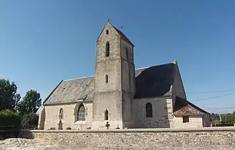 The church in Coulonces | |
Location of Coulonces | |
 Coulonces  Coulonces | |
| Coordinates: 48°50′13″N 0°00′30″E / 48.8369°N 0.0083°E | |
| Country | France |
| Region | Normandy |
| Department | Orne |
| Arrondissement | Argentan |
| Canton | Argentan-2 |
| Intercommunality | Terres d'Argentan Interco |
| Government | |
| • Mayor (2020–2026) | Daniel Marrière[1] |
Area 1 | 6.15 km2 (2.37 sq mi) |
| Population (2022)[2] | 212 |
| • Density | 34/km2 (89/sq mi) |
| Time zone | UTC+01:00 (CET) |
| • Summer (DST) | UTC+02:00 (CEST) |
| INSEE/Postal code | 61123 /61160 |
| Elevation | 75–141 m (246–463 ft) (avg. 65 m or 213 ft) |
| 1 French Land Register data, which excludes lakes, ponds, glaciers > 1 km2 (0.386 sq mi or 247 acres) and river estuaries. | |
Coulonces is a commune in the Orne department in north-western France.
Geography
The commune is made up of the following collection of villages and hamlets, La Villette and Coulonces.[3]
The commune has the River Dives running through it and one stream, Merdret's Creek.[4]
Neighbouring communes[3] | |
|---|---|
See also
References
- ^ "Répertoire national des élus: les maires". data.gouv.fr, Plateforme ouverte des données publiques françaises (in French). 9 August 2021.
- ^ "Populations de référence 2022" (in French). The National Institute of Statistics and Economic Studies. 19 December 2024.
- ^ a b "Google Maps". Google Maps.
- ^ Sandre. "Fiche cours d'eau - La Dives (I1--0200)".
Wikimedia Commons has media related to Coulonces (Orne).