Pontchardon
Pontchardon | |
|---|---|
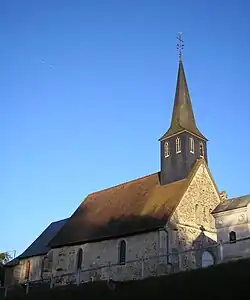 The church in Pontchardon | |
Location of Pontchardon | |
 Pontchardon  Pontchardon | |
| Coordinates: 48°55′46″N 0°16′02″E / 48.9294°N 0.2672°E | |
| Country | France |
| Region | Normandy |
| Department | Orne |
| Arrondissement | Mortagne-au-Perche |
| Canton | Vimoutiers |
| Intercommunality | Vallées d'Auge et du Merlerault |
| Government | |
| • Mayor (2020–2026) | Gérard Tanguy[1] |
Area 1 | 4.83 km2 (1.86 sq mi) |
| Population (2022)[2] | 184 |
| • Density | 38/km2 (99/sq mi) |
| Time zone | UTC+01:00 (CET) |
| • Summer (DST) | UTC+02:00 (CEST) |
| INSEE/Postal code | 61333 /61120 |
| Elevation | 122–221 m (400–725 ft) (avg. 180 m or 590 ft) |
| 1 French Land Register data, which excludes lakes, ponds, glaciers > 1 km2 (0.386 sq mi or 247 acres) and river estuaries. | |
Pontchardon (French pronunciation: [pɔ̃ʃaʁdɔ̃] ⓘ) is a commune in the Orne department in Normandy, north-western France.
Geography
The commune along with another 11 communes shares part of a 1,400 hectare, Natura 2000 conservation area, called the Haute Vallée de la Touques et affluents.[3]
See also
References
- ^ "Répertoire national des élus: les maires" (in French). data.gouv.fr, Plateforme ouverte des données publiques françaises. 13 September 2022.
- ^ "Populations de référence 2022" (in French). The National Institute of Statistics and Economic Studies. 19 December 2024.
- ^ "INPN - FSD Natura 2000 - FR2500103 - Haute Vallée de la Touques et affluents - Description".
Wikimedia Commons has media related to Pontchardon.