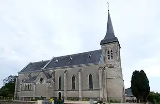
Le Plantis
Le Plantis | |
|---|---|
 | |
Location of Le Plantis | |
 Le Plantis  Le Plantis | |
| Coordinates: 48°36′06″N 0°22′56″E / 48.6017°N 0.3822°E | |
| Country | France |
| Region | Normandy |
| Department | Orne |
| Arrondissement | Alençon |
| Canton | Écouves |
| Intercommunality | Vallée de la Haute Sarthe |
| Government | |
| • Mayor (2020–2026) | Eric Liger[1] |
Area 1 | 8.02 km2 (3.10 sq mi) |
| Population (2022)[2] | 126 |
| • Density | 16/km2 (41/sq mi) |
| Demonym | Plantisiens |
| Time zone | UTC+01:00 (CET) |
| • Summer (DST) | UTC+02:00 (CEST) |
| INSEE/Postal code | 61331 /61170 |
| Elevation | 163–243 m (535–797 ft) (avg. 175 m or 574 ft) |
| 1 French Land Register data, which excludes lakes, ponds, glaciers > 1 km2 (0.386 sq mi or 247 acres) and river estuaries. | |
Le Plantis (French pronunciation: [lə plɑ̃ti]) is a commune in the Orne department in north-western France.
Geography
The commune along with another 32 communes is part of a 3,503 hectare, Natura 2000 conservation area, called the Haute vallée de la Sarthe.[3]
See also
References
- ^ "Répertoire national des élus: les maires". data.gouv.fr, Plateforme ouverte des données publiques françaises (in French). 9 August 2021.
- ^ "Populations de référence 2022" (in French). The National Institute of Statistics and Economic Studies. 19 December 2024.
- ^ "INPN - FSD Natura 2000 - FR2500107 - Haute Vallée de la Sarthe - Description". Archived from the original on 31 July 2024. Retrieved 31 August 2024.
Wikimedia Commons has media related to Le Plantis.