Laleu, Orne
Laleu | |
|---|---|
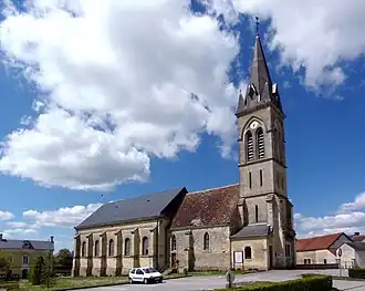 The church in Laleu | |
Location of Laleu | |
 Laleu  Laleu | |
| Coordinates: 48°33′08″N 0°22′48″E / 48.5522°N 0.38°E | |
| Country | France |
| Region | Normandy |
| Department | Orne |
| Arrondissement | Alençon |
| Canton | Écouves |
| Intercommunality | Vallée de la Haute Sarthe |
| Government | |
| • Mayor (2020–2026) | Raymond Denis[1] |
Area 1 | 11.41 km2 (4.41 sq mi) |
| Population (2022)[2] | 361 |
| • Density | 32/km2 (82/sq mi) |
| Time zone | UTC+01:00 (CET) |
| • Summer (DST) | UTC+02:00 (CEST) |
| INSEE/Postal code | 61215 /61170 |
| Elevation | 148–214 m (486–702 ft) (avg. 185 m or 607 ft) |
| 1 French Land Register data, which excludes lakes, ponds, glaciers > 1 km2 (0.386 sq mi or 247 acres) and river estuaries. | |
Laleu (French pronunciation: [lalø] ⓘ) is a commune in the Orne department in north-western France.
Geography
The commune along with another 32 communes is part of a 3,503 hectare, Natura 2000 conservation area, called the Haute vallée de la Sarthe.[3]
Population
| Year | Pop. | ±% p.a. |
|---|---|---|
| 1968 | 335 | — |
| 1975 | 347 | +0.50% |
| 1982 | 327 | −0.84% |
| 1990 | 361 | +1.24% |
| 1999 | 343 | −0.57% |
| 2007 | 375 | +1.12% |
| 2012 | 362 | −0.70% |
| 2017 | 360 | −0.11% |
| Source: INSEE[4] | ||
See also
References
- ^ "Répertoire national des élus: les maires". data.gouv.fr, Plateforme ouverte des données publiques françaises (in French). 2 December 2020.
- ^ "Populations de référence 2022" (in French). The National Institute of Statistics and Economic Studies. 19 December 2024.
- ^ "INPN - FSD Natura 2000 - FR2500107 - Haute Vallée de la Sarthe - Description".
- ^ Population en historique depuis 1968, INSEE
Wikimedia Commons has media related to Laleu (Orne).