Mont-Ormel
Mont-Ormel | |
|---|---|
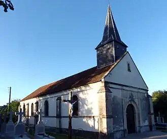 The church in Mont-Ormel | |
Location of Mont-Ormel | |
 Mont-Ormel  Mont-Ormel | |
| Coordinates: 48°50′26″N 0°09′24″E / 48.8406°N 0.1567°E | |
| Country | France |
| Region | Normandy |
| Department | Orne |
| Arrondissement | Argentan |
| Canton | Argentan-2 |
| Intercommunality | Terres d'Argentan Interco |
| Government | |
| • Mayor (2020–2026) | Patricia Le Feuvrier[1] |
Area 1 | 3.73 km2 (1.44 sq mi) |
| Population (2022)[2] | 49 |
| • Density | 13/km2 (34/sq mi) |
| Time zone | UTC+01:00 (CET) |
| • Summer (DST) | UTC+02:00 (CEST) |
| INSEE/Postal code | 61289 /61160 |
| Elevation | 177–263 m (581–863 ft) (avg. 262 m or 860 ft) |
| 1 French Land Register data, which excludes lakes, ponds, glaciers > 1 km2 (0.386 sq mi or 247 acres) and river estuaries. | |
Mont-Ormel (French pronunciation: [mɔ̃.t‿ɔʁmɛl] ⓘ) is a commune in the Orne department in north-western France.
Geography
The commune is made up of the following collection of villages and hamlets, La Panthelière and Mont-Ormel.[3]
The commune has one streamsrunning through its borders, the Mont-Ormel.
Neighbouring communes[3] | ||||||||||||||||
|---|---|---|---|---|---|---|---|---|---|---|---|---|---|---|---|---|
| ||||||||||||||||
Notable buildings and places
Memorial de Montormel is a memorial and museum on the site of battle of Falaise pocket between Chambois and Vimoutiers.[4]
-
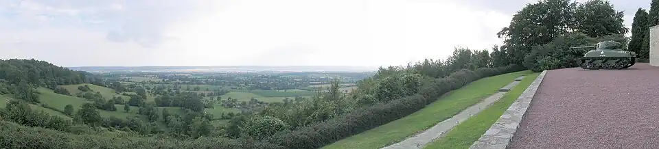 View of the battleground from the Memorial de Montormel
See also
References
- ^ "Répertoire national des élus: les maires". data.gouv.fr, Plateforme ouverte des données publiques françaises (in French). 9 August 2021.
- ^ "Populations de référence 2022" (in French). The National Institute of Statistics and Economic Studies. 19 December 2024.
- ^ a b "Google Maps". Google Maps.
- ^ "Memorial de Montormel". Normandy War guide.
Wikimedia Commons has media related to Mont-Ormel.