Brognard
Brognard | |
|---|---|
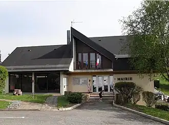 Town hall | |
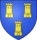 Coat of arms | |
Location of Brognard | |
 Brognard  Brognard | |
| Coordinates: 47°31′51″N 6°51′54″E / 47.5308°N 6.865°E | |
| Country | France |
| Region | Bourgogne-Franche-Comté |
| Department | Doubs |
| Arrondissement | Montbéliard |
| Canton | Bethoncourt |
| Intercommunality | Pays de Montbéliard Agglomération |
| Government | |
| • Mayor (2020–2026) | Gladys Bainier[1] |
Area 1 | 2.9 km2 (1.1 sq mi) |
| Population (2022)[2] | 477 |
| • Density | 160/km2 (430/sq mi) |
| Time zone | UTC+01:00 (CET) |
| • Summer (DST) | UTC+02:00 (CEST) |
| INSEE/Postal code | 25097 /25600 |
| Elevation | 319–383 m (1,047–1,257 ft) |
| 1 French Land Register data, which excludes lakes, ponds, glaciers > 1 km2 (0.386 sq mi or 247 acres) and river estuaries. | |
Brognard (French pronunciation: [bʁɔɲaʁ]) is a commune in the Doubs department in the Bourgogne-Franche-Comté region in eastern France.
Population
| Year | Pop. | ±% |
|---|---|---|
| 1962 | 228 | — |
| 1968 | 254 | +11.4% |
| 1975 | 228 | −10.2% |
| 1982 | 275 | +20.6% |
| 1990 | 424 | +54.2% |
| 1999 | 417 | −1.7% |
| 2008 | 444 | +6.5% |
| 2012 | 456 | +2.7% |
See also
References
- ^ "Répertoire national des élus: les maires". data.gouv.fr, Plateforme ouverte des données publiques françaises (in French). 9 August 2021.
- ^ "Populations de référence 2022" (in French). The National Institute of Statistics and Economic Studies. 19 December 2024.
External links
Wikimedia Commons has media related to Brognard.
- Pays de Montbéliard website (in French)