Narbief
Narbief | |
|---|---|
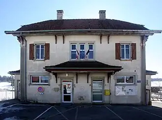 The town hall in Narbief | |
Location of Narbief | |
 Narbief  Narbief | |
| Coordinates: 47°08′00″N 6°42′00″E / 47.1333°N 6.7°E | |
| Country | France |
| Region | Bourgogne-Franche-Comté |
| Department | Doubs |
| Arrondissement | Pontarlier |
| Canton | Morteau |
| Intercommunality | Plateau du Russey |
| Government | |
| • Mayor (2020–2026) | Jérôme Renaud[1] |
Area 1 | 3.47 km2 (1.34 sq mi) |
| Population (2022)[2] | 99 |
| • Density | 29/km2 (74/sq mi) |
| Time zone | UTC+01:00 (CET) |
| • Summer (DST) | UTC+02:00 (CEST) |
| INSEE/Postal code | 25421 /25210 |
| Elevation | 879–935 m (2,884–3,068 ft) |
| 1 French Land Register data, which excludes lakes, ponds, glaciers > 1 km2 (0.386 sq mi or 247 acres) and river estuaries. | |
Narbief is a commune in the Doubs department in the Bourgogne-Franche-Comté region in eastern France.
Population
| Year | Pop. | ±% |
|---|---|---|
| 1962 | 58 | — |
| 1968 | 60 | +3.4% |
| 1975 | 66 | +10.0% |
| 1982 | 58 | −12.1% |
| 1990 | 55 | −5.2% |
| 1999 | 70 | +27.3% |
| 2008 | 74 | +5.7% |
| 2012 | 67 | −9.5% |
See also
References
- ^ "Répertoire national des élus: les maires". data.gouv.fr, Plateforme ouverte des données publiques françaises (in French). 2 December 2020.
- ^ "Populations de référence 2022" (in French). The National Institute of Statistics and Economic Studies. 19 December 2024.
Wikimedia Commons has media related to Narbief.