Gevresin
Gevresin | |
|---|---|
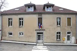 The town hall in Gevresin | |
Location of Gevresin | |
 Gevresin  Gevresin | |
| Coordinates: 46°58′05″N 6°02′34″E / 46.9681°N 6.0428°E | |
| Country | France |
| Region | Bourgogne-Franche-Comté |
| Department | Doubs |
| Arrondissement | Besançon |
| Canton | Ornans |
| Intercommunality | Altitude 800 |
| Government | |
| • Mayor (2020–2026) | Louis Bourgeois[1] |
Area 1 | 6.91 km2 (2.67 sq mi) |
| Population (2022)[2] | 153 |
| • Density | 22/km2 (57/sq mi) |
| Time zone | UTC+01:00 (CET) |
| • Summer (DST) | UTC+02:00 (CEST) |
| INSEE/Postal code | 25270 /25270 |
| Elevation | 650–783 m (2,133–2,569 ft) |
| 1 French Land Register data, which excludes lakes, ponds, glaciers > 1 km2 (0.386 sq mi or 247 acres) and river estuaries. | |
Gevresin (French pronunciation: [ʒəvʁəzɛ̃]) is a commune in the Doubs department in the region of Bourgogne-Franche-Comté in eastern France.
Population
| Year | Pop. | ±% |
|---|---|---|
| 1962 | 106 | — |
| 1968 | 110 | +3.8% |
| 1975 | 101 | −8.2% |
| 1982 | 97 | −4.0% |
| 1990 | 106 | +9.3% |
| 1999 | 107 | +0.9% |
| 2008 | 110 | +2.8% |
| 2012 | 120 | +9.1% |
See also
References
- ^ "Répertoire national des élus: les maires". data.gouv.fr, Plateforme ouverte des données publiques françaises (in French). 9 August 2021.
- ^ "Populations de référence 2022" (in French). The National Institute of Statistics and Economic Studies. 19 December 2024.
Wikimedia Commons has media related to Gevresin.