Noirefontaine
Noirefontaine | |
|---|---|
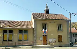 The town hall in Noirefontaine | |
.svg.png) Coat of arms | |
Location of Noirefontaine | |
 Noirefontaine  Noirefontaine | |
| Coordinates: 47°20′59″N 6°45′46″E / 47.3497°N 6.7628°E | |
| Country | France |
| Region | Bourgogne-Franche-Comté |
| Department | Doubs |
| Arrondissement | Montbéliard |
| Canton | Valentigney |
| Intercommunality | Pays de Montbéliard Agglomération |
| Government | |
| • Mayor (2020–2026) | Marie-Line Lebrun[1] |
Area 1 | 3.35 km2 (1.29 sq mi) |
| Population (2022)[2] | 325 |
| • Density | 97/km2 (250/sq mi) |
| Time zone | UTC+01:00 (CET) |
| • Summer (DST) | UTC+02:00 (CEST) |
| INSEE/Postal code | 25426 /25190 |
| Elevation | 350–630 m (1,150–2,070 ft) |
| 1 French Land Register data, which excludes lakes, ponds, glaciers > 1 km2 (0.386 sq mi or 247 acres) and river estuaries. | |
Noirefontaine (French pronunciation: [nwaʁfɔ̃tɛn]) is a commune in the Doubs department in the Bourgogne-Franche-Comté region in eastern France.
Geography
The commune lies 4 km (2.5 mi) south of Pont-de-Roide between the Doubs and the Lomont on a major highway.
Population
| Year | Pop. | ±% |
|---|---|---|
| 1962 | 252 | — |
| 1968 | 252 | +0.0% |
| 1975 | 292 | +15.9% |
| 1982 | 416 | +42.5% |
| 1990 | 404 | −2.9% |
| 1999 | 384 | −5.0% |
| 2008 | 357 | −7.0% |
| 2012 | 375 | +5.0% |
See also
References
- ^ "Répertoire national des élus: les maires". data.gouv.fr, Plateforme ouverte des données publiques françaises (in French). 9 August 2021.
- ^ "Populations de référence 2022" (in French). The National Institute of Statistics and Economic Studies. 19 December 2024.
External links
Wikimedia Commons has media related to Noirefontaine (Doubs).