Sainte-Suzanne, Doubs
Sainte-Suzanne | |
|---|---|
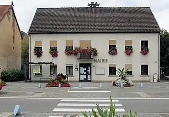 The town hall in Sainte-Suzanne | |
 Coat of arms | |
Location of Sainte-Suzanne | |
 Sainte-Suzanne  Sainte-Suzanne | |
| Coordinates: 47°30′25″N 6°46′24″E / 47.5069°N 6.7733°E | |
| Country | France |
| Region | Bourgogne-Franche-Comté |
| Department | Doubs |
| Arrondissement | Montbéliard |
| Canton | Montbéliard |
| Intercommunality | Pays de Montbéliard Agglomération |
| Government | |
| • Mayor (2020–2026) | Frédéric Tchobanian[1] |
Area 1 | 1.59 km2 (0.61 sq mi) |
| Population (2022)[2] | 1,461 |
| • Density | 920/km2 (2,400/sq mi) |
| Time zone | UTC+01:00 (CET) |
| • Summer (DST) | UTC+02:00 (CEST) |
| INSEE/Postal code | 25526 /25630 |
| Elevation | 310–405 m (1,017–1,329 ft) |
| 1 French Land Register data, which excludes lakes, ponds, glaciers > 1 km2 (0.386 sq mi or 247 acres) and river estuaries. | |
Sainte-Suzanne (French pronunciation: [sɛ̃t syzan]) is a commune in the Doubs department in the Bourgogne-Franche-Comté region in eastern France.
Geography
The commune lies 2 km (1.2 mi) southwest of Montbéliard. It forms an arc of which each end rejoins the Allan River.
Population
| Year | Pop. | ±% |
|---|---|---|
| 1962 | 1,350 | — |
| 1968 | 1,429 | +5.9% |
| 1975 | 1,448 | +1.3% |
| 1982 | 1,296 | −10.5% |
| 1990 | 1,246 | −3.9% |
| 1999 | 1,349 | +8.3% |
| 2008 | 1,444 | +7.0% |
| 2012 | 1,527 | +5.7% |
See also
References
- ^ "Répertoire national des élus: les maires". data.gouv.fr, Plateforme ouverte des données publiques françaises (in French). 9 August 2021.
- ^ "Populations de référence 2022" (in French). The National Institute of Statistics and Economic Studies. 19 December 2024.
External links
Wikimedia Commons has media related to Sainte-Suzanne (Doubs).
- Official website Archived 28 February 2009 at the Wayback Machine (in French)
- Sainte-Suzanne on the regional Web site (in French)