Nans, Doubs
Nans | |
|---|---|
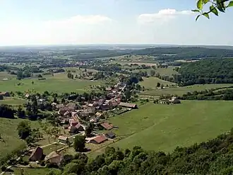 Nans, from Les Roches | |
 Coat of arms | |
Location of Nans | |
 Nans  Nans | |
| Coordinates: 47°28′45″N 6°25′07″E / 47.4793°N 6.4187°E | |
| Country | France |
| Region | Bourgogne-Franche-Comté |
| Department | Doubs |
| Arrondissement | Besançon |
| Canton | Baume-les-Dames |
| Government | |
| • Mayor (2020–2026) | Daniel Menier[1] |
Area 1 | 3.2 km2 (1.2 sq mi) |
| Population (2022)[2] | 92 |
| • Density | 29/km2 (74/sq mi) |
| Time zone | UTC+01:00 (CET) |
| • Summer (DST) | UTC+02:00 (CEST) |
| INSEE/Postal code | 25419 /25684 |
| Elevation | 288–452 m (945–1,483 ft) |
| 1 French Land Register data, which excludes lakes, ponds, glaciers > 1 km2 (0.386 sq mi or 247 acres) and river estuaries. | |
Nans is a commune in the Doubs department in the Bourgogne-Franche-Comté region in eastern France.
Geography
Nans lies 5 km (3.1 mi) from Rougemont at the foot of a high, horseshoe-shaped cliff.
Population
| Year | Pop. | ±% |
|---|---|---|
| 1962 | 87 | — |
| 1968 | 89 | +2.3% |
| 1975 | 91 | +2.2% |
| 1982 | 99 | +8.8% |
| 1990 | 95 | −4.0% |
| 1999 | 88 | −7.4% |
| 2008 | 84 | −4.5% |
| 2012 | 94 | +11.9% |
See also
References
- ^ "Répertoire national des élus: les maires". data.gouv.fr, Plateforme ouverte des données publiques françaises (in French). 9 August 2021.
- ^ "Populations de référence 2022" (in French). The National Institute of Statistics and Economic Studies. 19 December 2024.
External links
Wikimedia Commons has media related to Nans.